| Previous :: Next Topic |
| Author |
Message |
John Morrow
Member


Joined: 03 Apr 2007
Posts: 1526 | TRs | Pics
Location: Roslyn |
It doesn't get better in the desert......
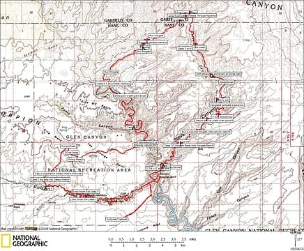
Glen Canyon National Recreation Area:
Crack in the Wall Route to Coyote Gulch/Escalante River.
Up Stevens Canyon complete ascent to Fold Pass.
Down Fold Canyon complete descent from Fold Pass.
Down Escalante River 7 mile wade and thrash.
Up Bobway Canyon to mesa.
Kings Mesa crossing.
Down Long Branch Sleepy Hollow Rim to Sleepy Hollow.
Down Coyote Gulch.
Crack in the Wall ascent to Trailhead.
53 mile loop.
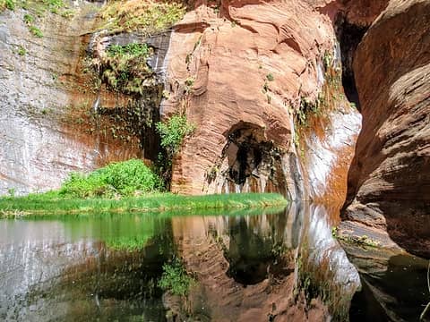
 Stevens Full Loop 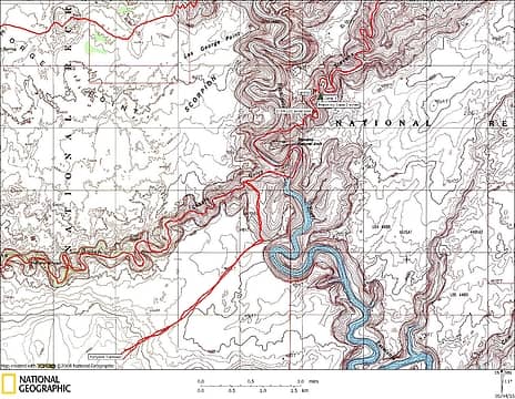 Stevens Day 1 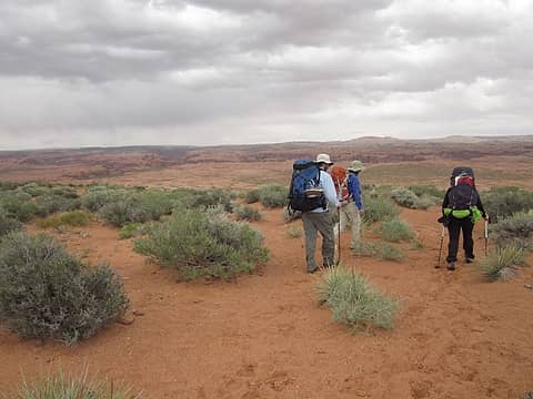 Starting Out 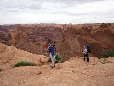 To the River! 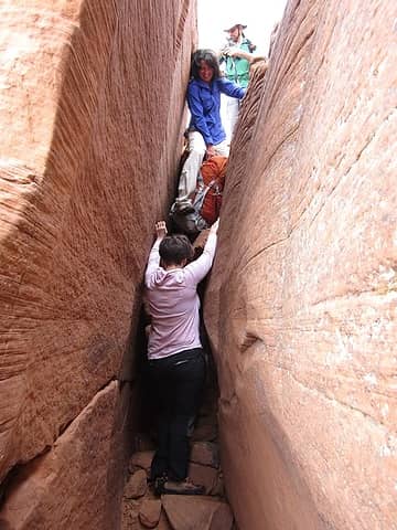 First, Crack in the Wall 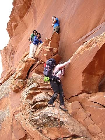 Class 3/4 Crack descent 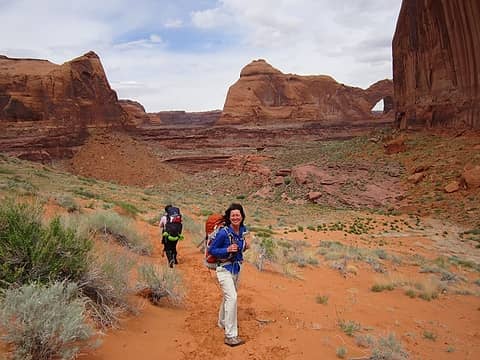 Happy, happy, Lori 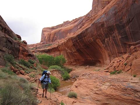 Jerry reaches Coyote Gulch 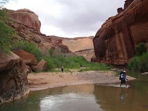 River with "The Crack" above 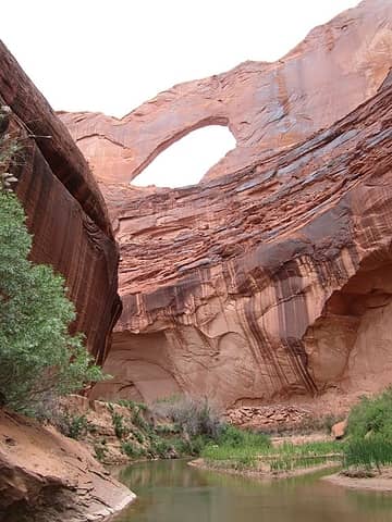 Stevens Arch over river 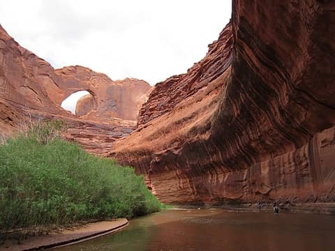 Glen Canyon National Recreation Area, UT. Glen Canyon Wilderness Study Area 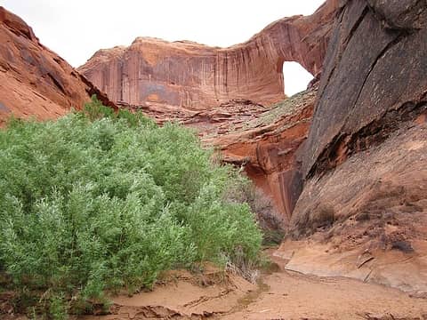 Our canyon start 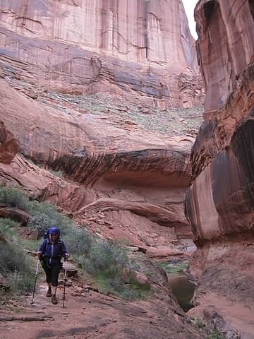 Into Stevens Canyon 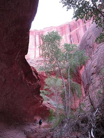 Stevens twists 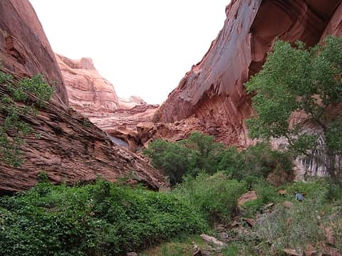 The "poison ivy slope" 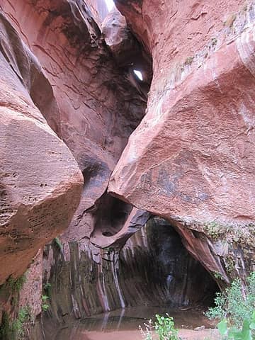 Grotto arch to be bypassed 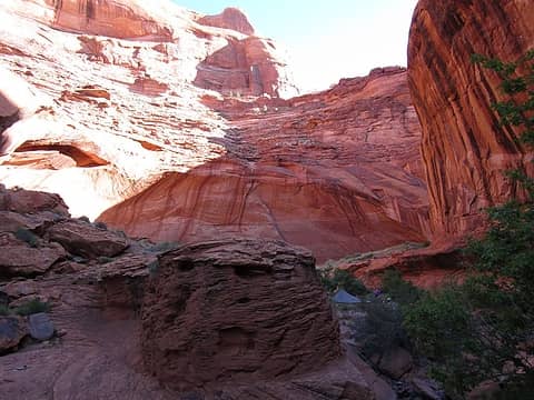 Camp 1 above "The Grotto" 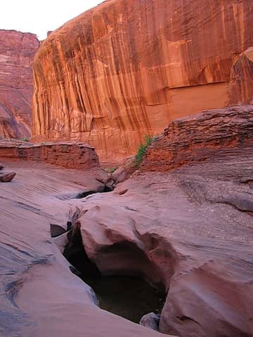 The grotto groove 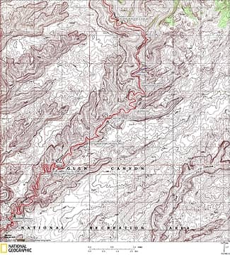 Stevens Day 2 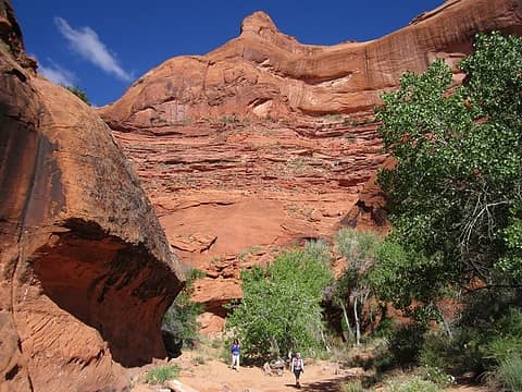 Serene Stevens 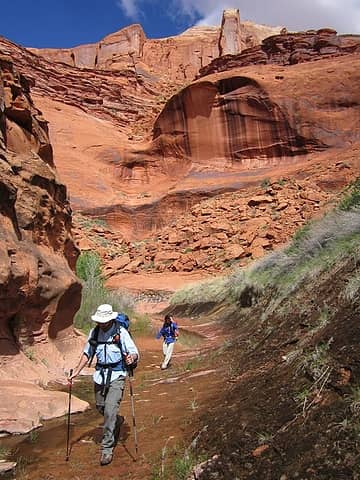 Well watered 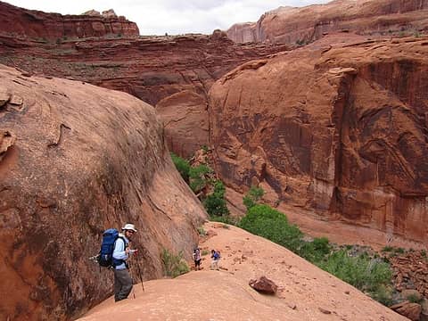 The "Class 3?" exit 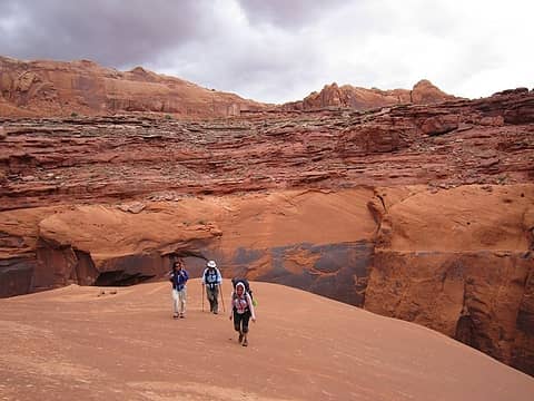 Onto the Wingate Bench 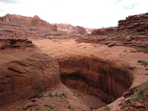 Moving along 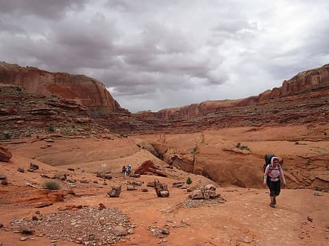 Kimberly loving it 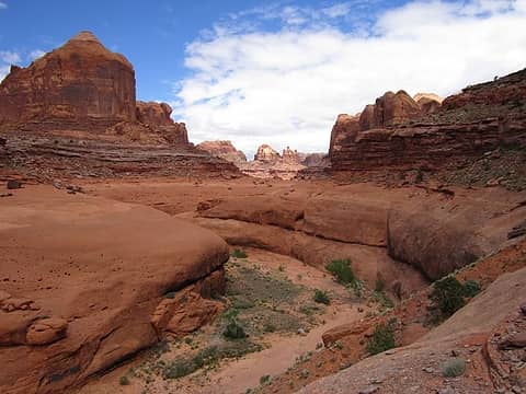 Glen Canyon National Recreation Area 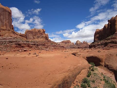 Big Navajo domes; Glen Canyon Natl Rec Area 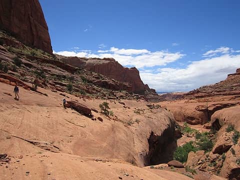 Traversin' 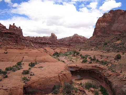 Glen Canyon National Recreation Area, UT 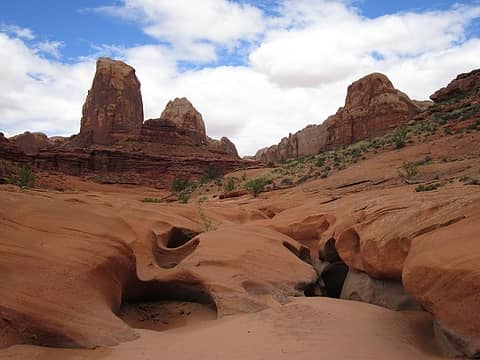 Key junction look 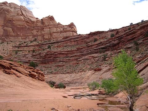 Beautiful Stevens scenes 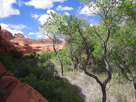 Ocassional tough brush 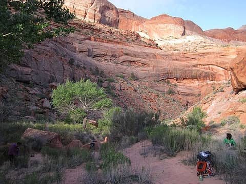 Camp 2 morning 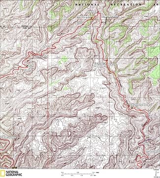 Stevens Day 3 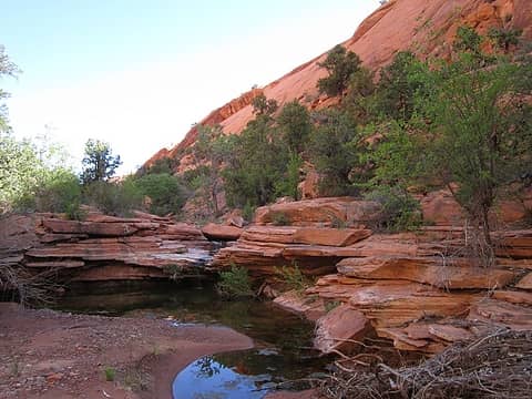 Idyllic waterfall 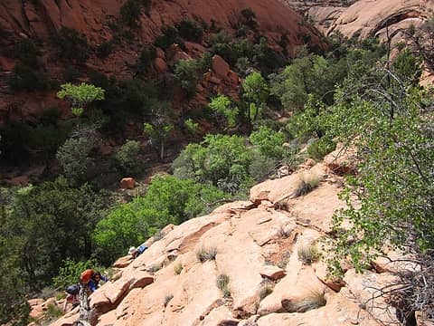 Time to climb out 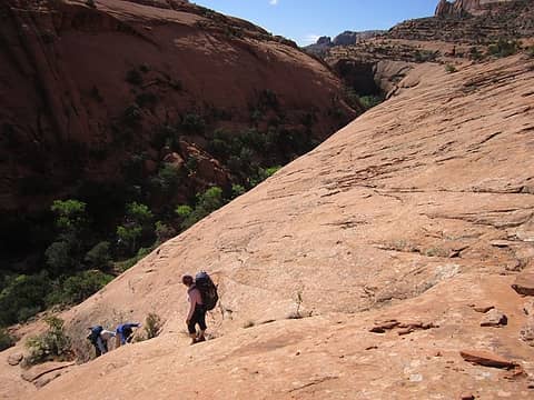 Class 4 "ish" exit 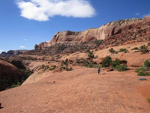 Back onto Wingate 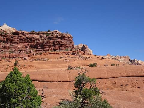 See 'em at right? 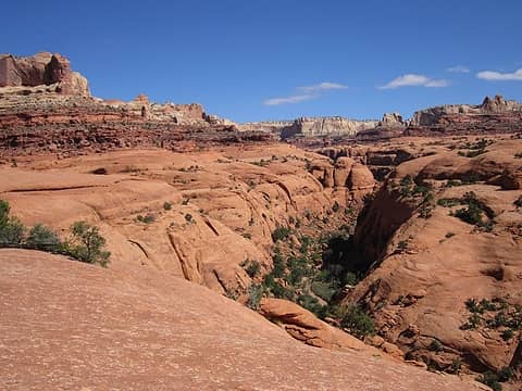 Nearing Steven's head 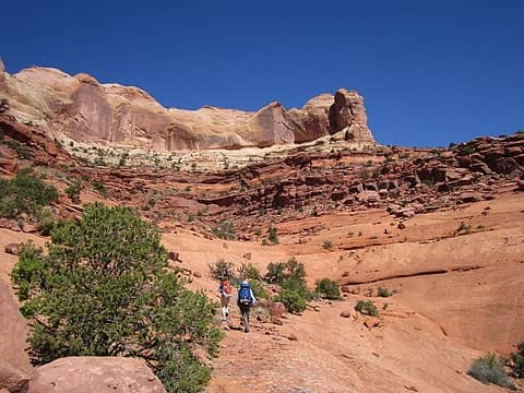 Kimberly moving along 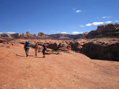 Grandeur 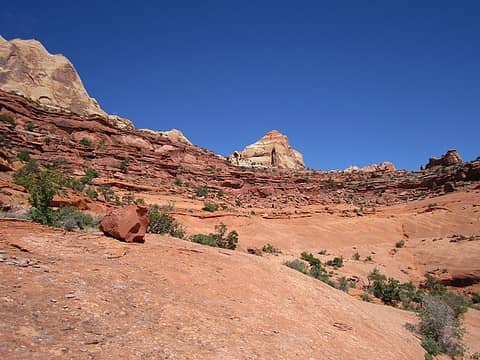 Our "key"enta exit 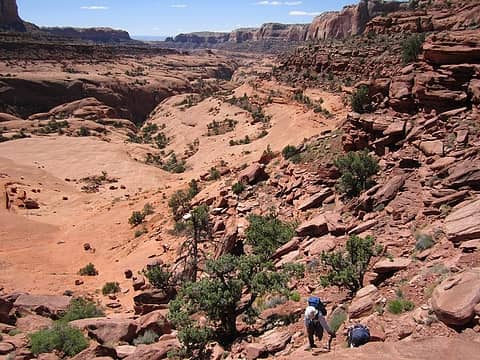 Kayenta climb 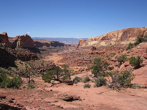 Yay! Fold Canyon 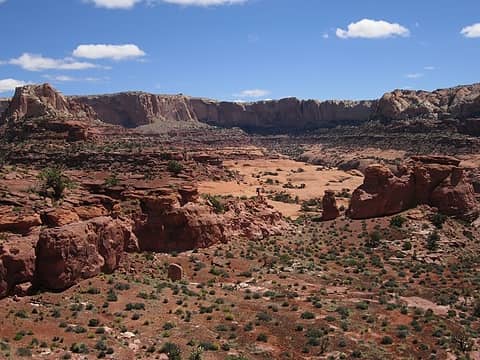 Jerry climbs out Stevens 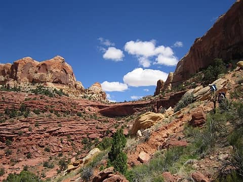 Descending Fold Pass 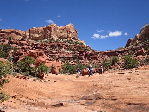 On firm Fold Canyon ground 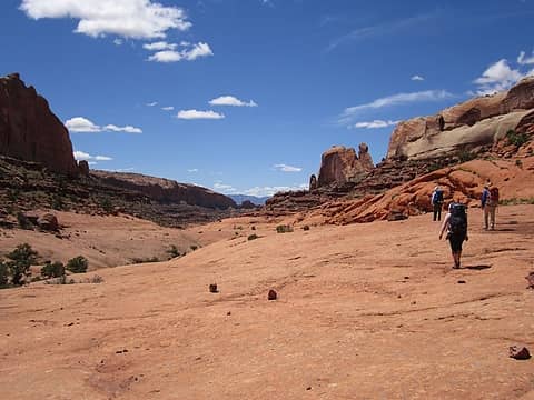 Moving down Fold 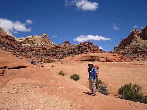 So gorgeous 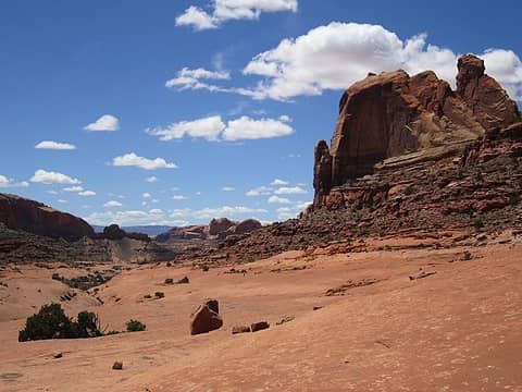 Un"Fold"ing drama 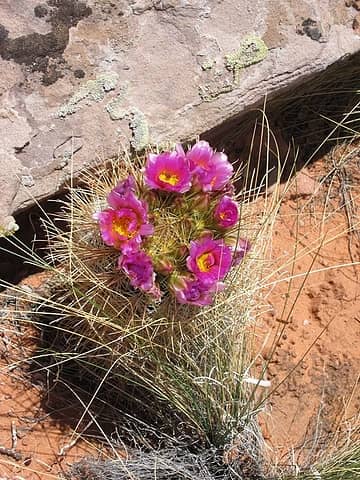 looking down the Barrel 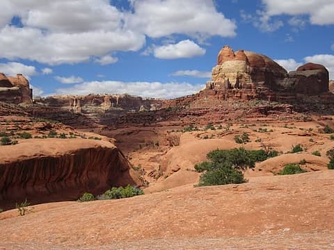 Fold Canyon in Glen Canyon National Recreation Area. Most only accessible via trailheads in GSENM. 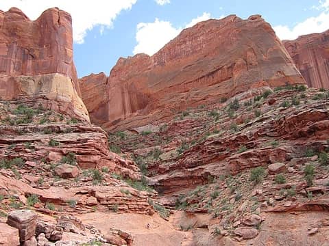 Kimberly scouts a way 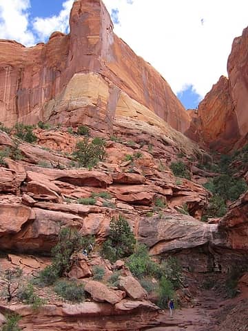 Crossing an obstruction 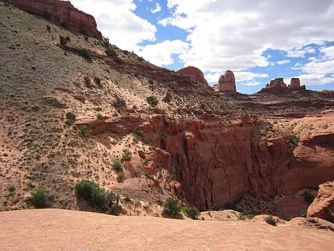 The sketch traverse "hell" dune 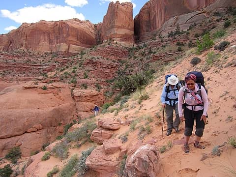 Dune exposure 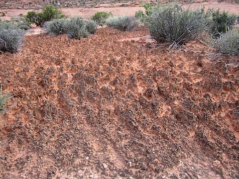 Old Growth crypto 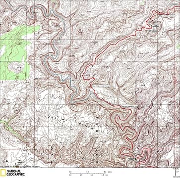 Stevens Day 4 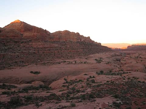 Camp 3 morning 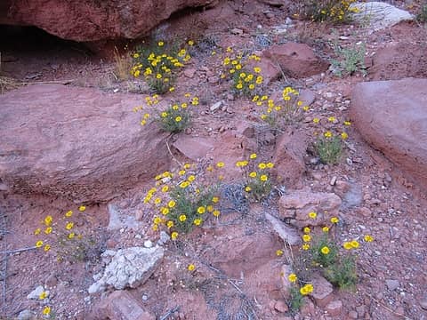 yellow 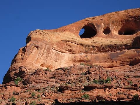 unnamed Fold arch 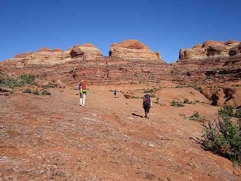 Departing Camp 3 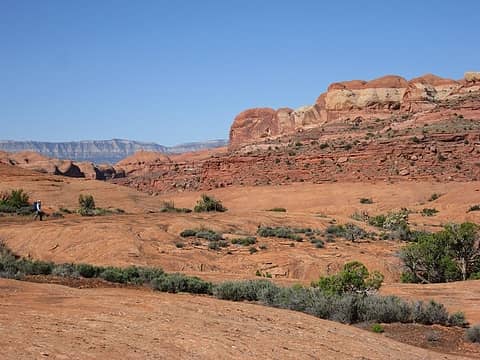 Jerry cruises Fold 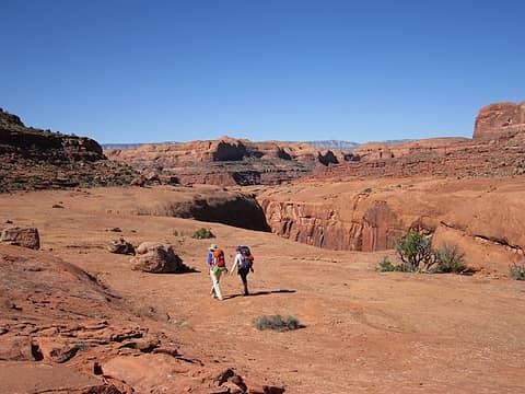 Friends catching up 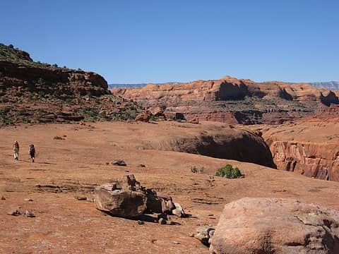 To the Escalante 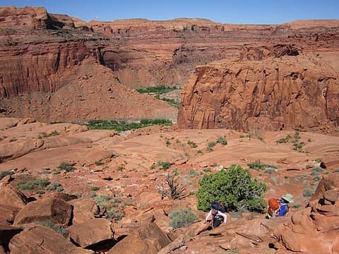 Leaving Fold for Escalante River 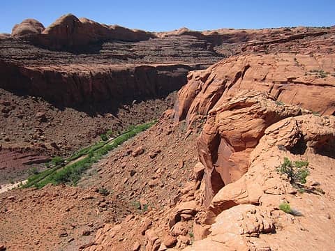 Where's our exit? 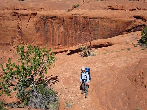 Jerry finds the "Twin arches" mark 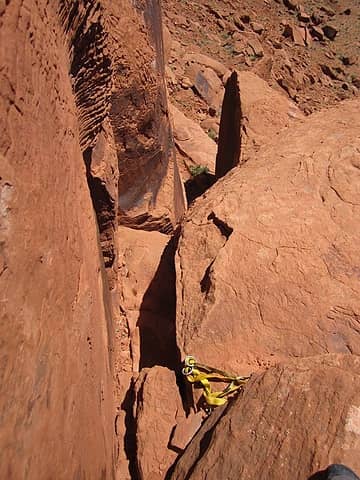 Steve Allen's Cl 5.3 descent 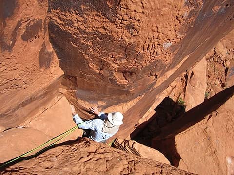 Jerry makes quick work of it 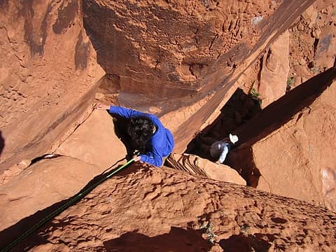 Lori's turn 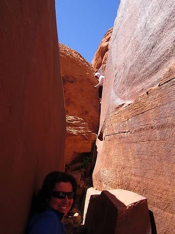 Kimberly descends 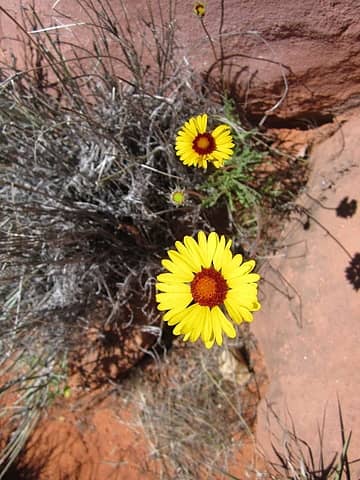 flower 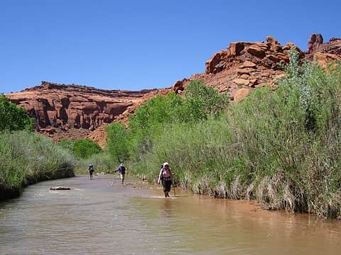 Lots of River wading  Out of the River 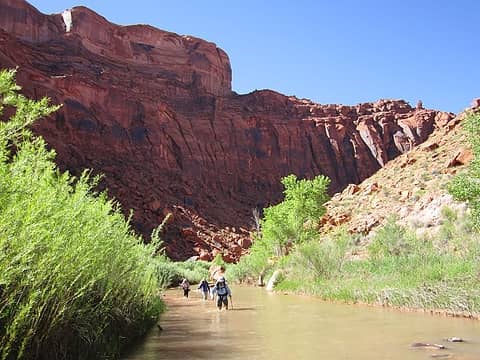 Back into the river 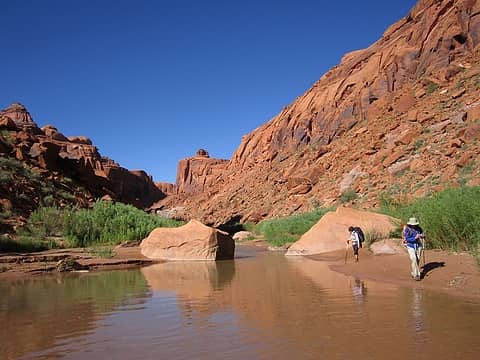 Out of river 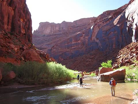 in again 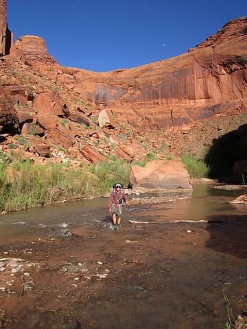 moon appears 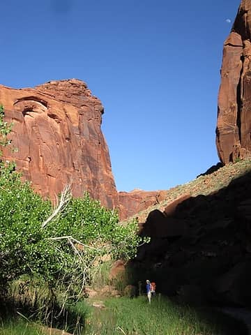 Lori and tall Escalante walls 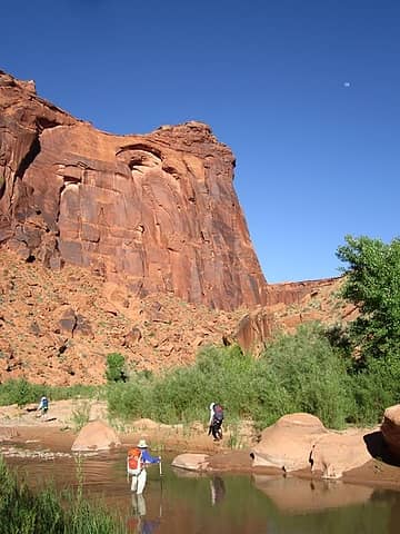 More crossings 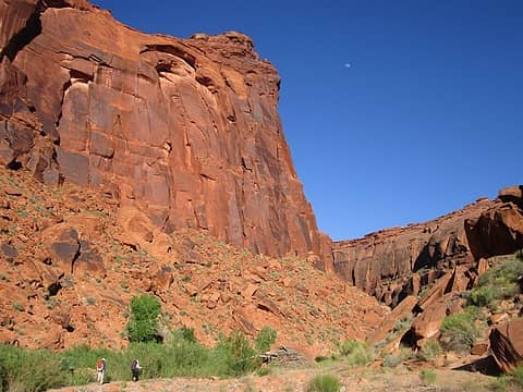 Nearing Camp 4 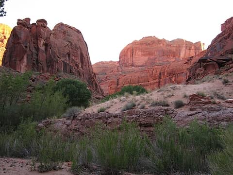 Fools Canyon appears 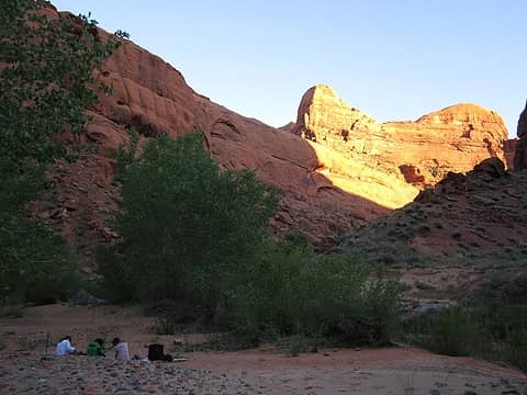 Camp 4 at Fools Canyon 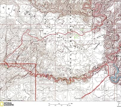 Stevens Days 5 and 6 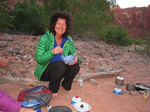 Folda cup o' joe 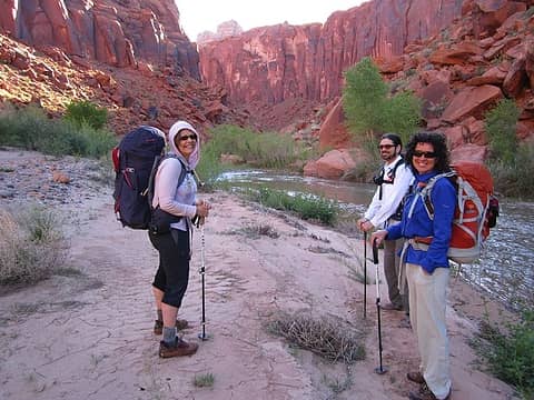 Still smilin' Day 5 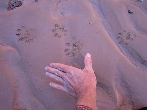 Looks like otter or other mustelid 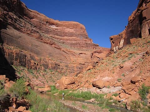 Tall Escalante River walls 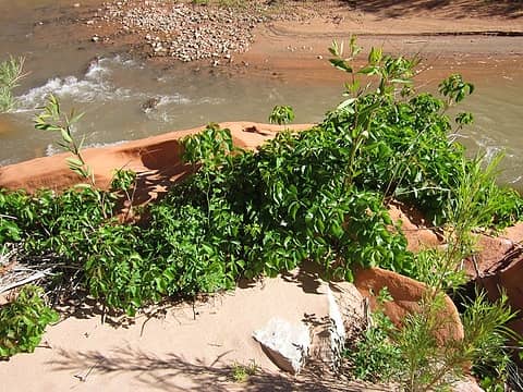 Our nemisis 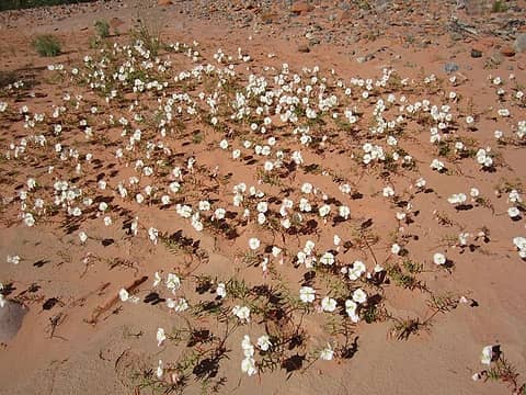 Primrose 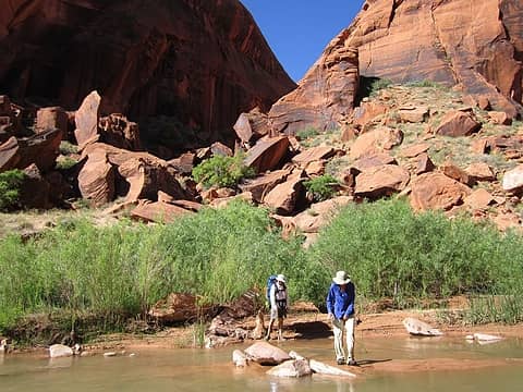 Water up at Bobway 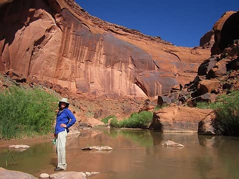 Bye bye river, Lori 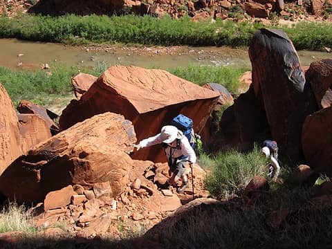 Hot Bobway climb 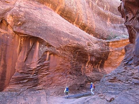 Cool Bobway entry 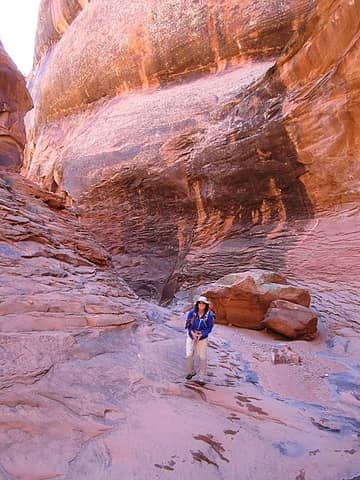 This place rocks! 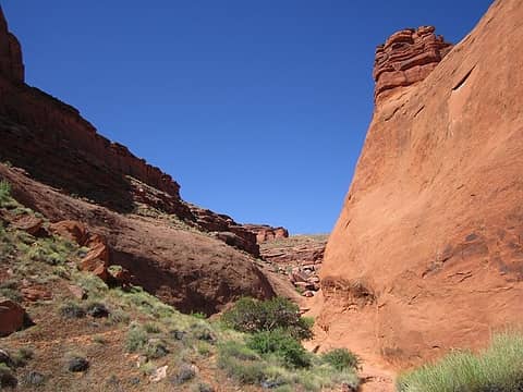 Hell dune climb up ahead 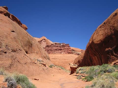 Bobway sidecanyon 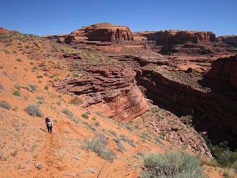 Tiring sand 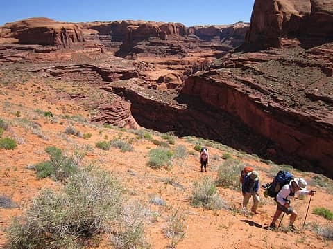 Almost up 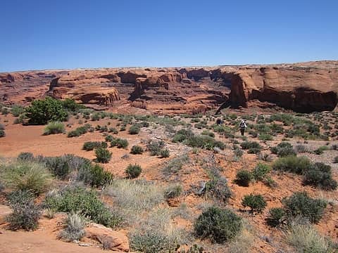 Last river view 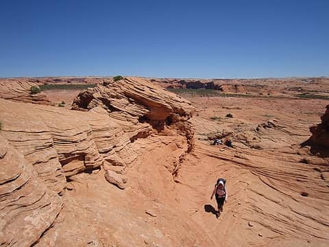 Onto the sea of slickrock 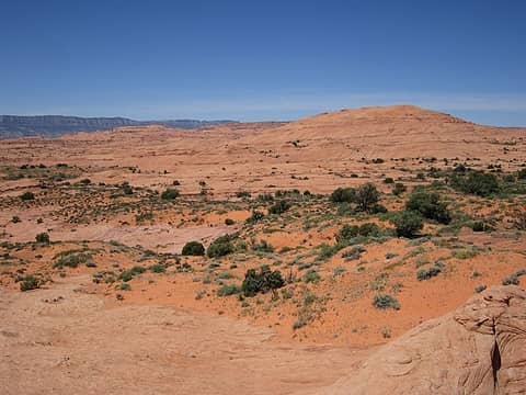 Head to the dome (Rock BM) 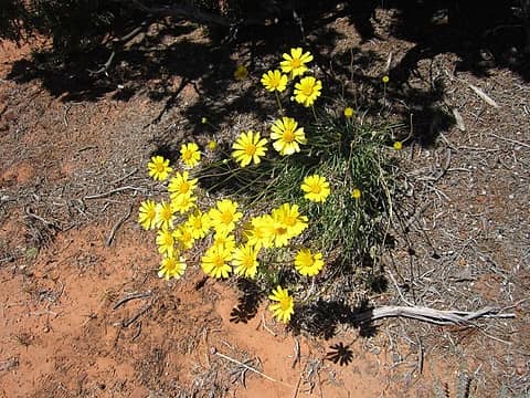 Yellow aster? 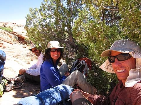 Sunbaked...Giveus shelter 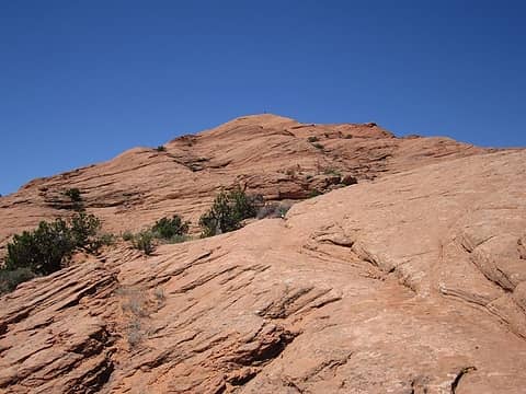 Kimberly on Rock BM. 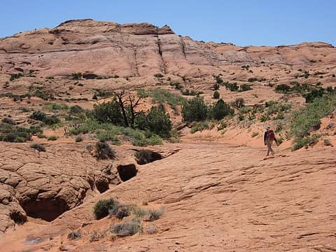 Headed for Sleepy Hollow Pass 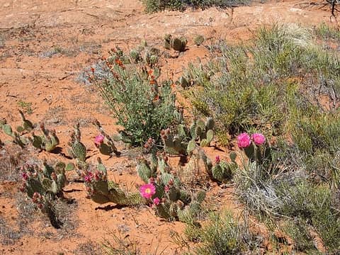 Garden 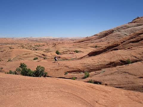 Kimberly finds a rib 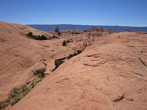 Oh sh_t moment! Pass not Pass 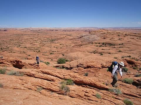 Must reset the course 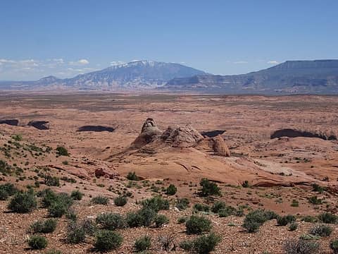 Navaho Mtn over Coyote Gulch 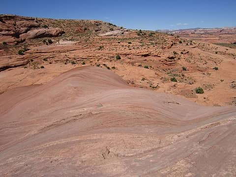 In a land of stone 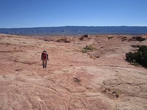 Lori skirts Sleepy hollow 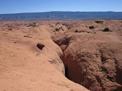 Long Branch Sleepy Hollow 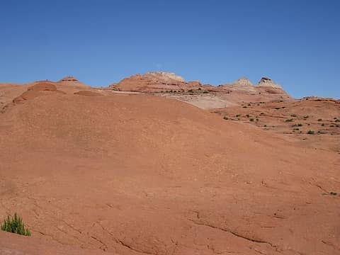 Sleepy Hollow moonrise 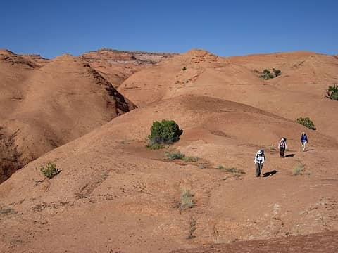 Descending rim left 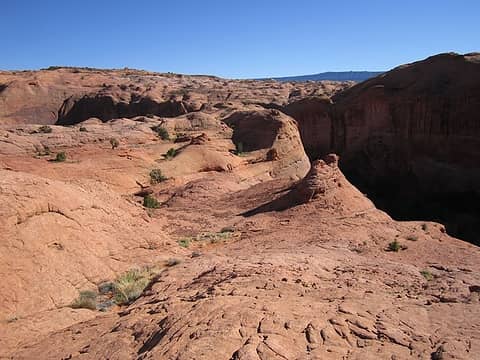 Ramp into Sleepy Hollow 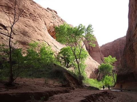 Day 6, Coyote Gulch start 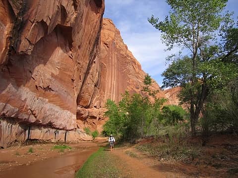 Jerry loving the tall walls 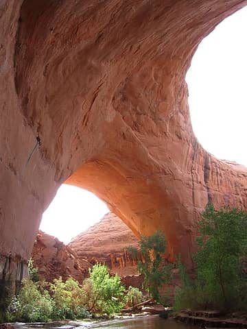 Jacob Hamblin Arch 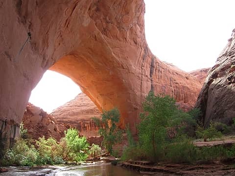 Coyote Gulch 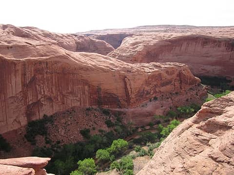 Coyote from top of Arch 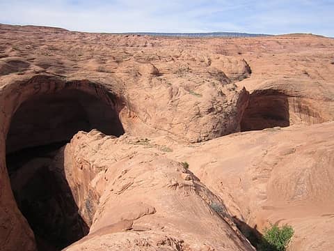 Probably should fix a hand line over a horn for one steep part if wearing multiday packs. One sling available at present. 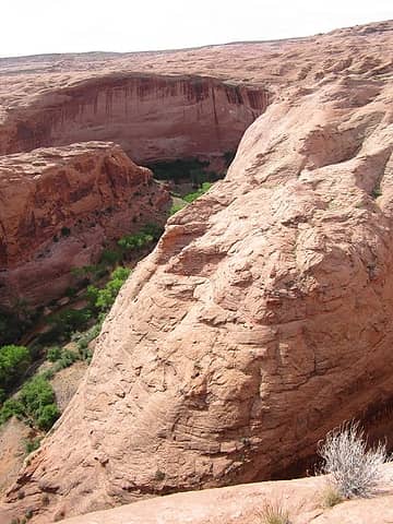 Scouted this after the JHA north exit scout. Can be ascended and descended with a big pack w/o gear. 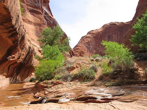 First Coyote falls 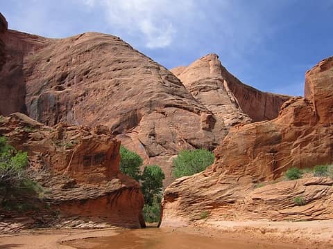 Coyote narrows 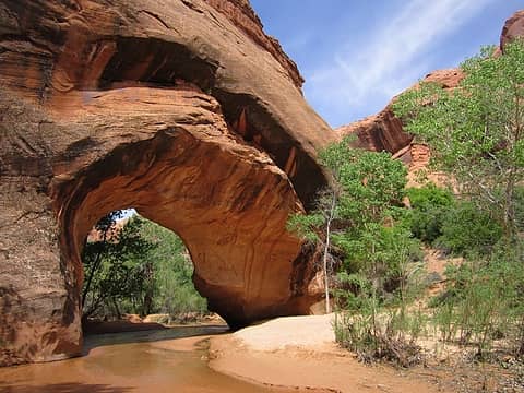 Coyote Bridge 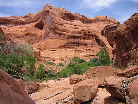 Cliff Arch behind Lori 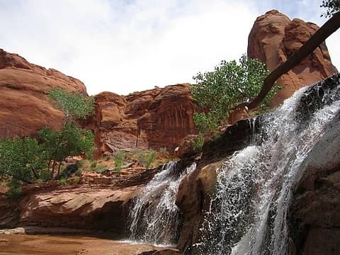 Glen Canyon National Recreation Area 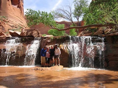 The gang! 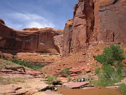 Coyote Gulch scene 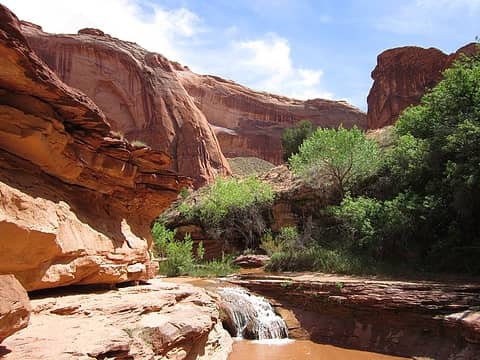 Glen Canyon National Recreation Area
Grand Staircase Escalante National Monument, UT 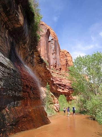 Cliff Spring! 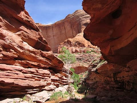 Narrowing through Kayenta 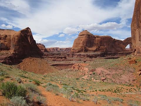 Time to climb to Crack
Tell me, what is it you plan to do with your one wild and precious life?-Mary Oliver
A nation that continues year after year to spend more money on military defense than on programs of social uplift is approaching spiritual doom.
― MLK Jr.
Tell me, what is it you plan to do with your one wild and precious life?-Mary Oliver
A nation that continues year after year to spend more money on military defense than on programs of social uplift is approaching spiritual doom.
― MLK Jr.
|
| Back to top |
  
|
|
GaliWalker
Have camera will use

Joined: 10 Dec 2007
Posts: 4955 | TRs | Pics
Location: Pittsburgh |
|
GaliWalker
Have camera will use
|
 Mon May 04, 2015 10:00 am |
|
|
 Looks fantastic, especially the grotto on day 1.
|
| Back to top |
|
|
Ski
><((((°>

Joined: 28 May 2005
Posts: 13027 | TRs | Pics
Location: tacoma |
|
Ski
><((((°>
|
Mon May 04, 2015 10:09 am |
|
|
fabulous, as always.
you are one lucky guy - trompin' around down there all the time! 
"I shall wear white flannel trousers, and walk upon the beach.
I have heard the mermaids singing, each to each."
"I shall wear white flannel trousers, and walk upon the beach.
I have heard the mermaids singing, each to each."
|
| Back to top |
|
|
Jim Dockery
Member

Joined: 12 Sep 2007
Posts: 3092 | TRs | Pics
Location: Lake Stevens |
Most excellent!
|
| Back to top |
|
|
yukon222
Member

Joined: 12 Mar 2007
Posts: 1895 | TRs | Pics
|
|
yukon222
Member
|
Mon May 04, 2015 8:17 pm |
|
|
Lots of interesting pics! Really like the attached maps too which show how convoluted the canyons are down there
|
| Back to top |
|
|
silence
Member
Joined: 25 Apr 2005
Posts: 4420 | TRs | Pics
|
|
silence
Member
|
Tue May 05, 2015 7:22 am |
|
|
Nice one John, etal! Been down to the confluence of Coyote with the Escalante ... but pales in comparison to your most excellent trip!
PHOTOS
FILMS
Keep a good head and always carry a light bulb. Bob Dylan
PHOTOS
FILMS
Keep a good head and always carry a light bulb. Bob Dylan
|
| Back to top |
|
|
John Morrow
Member
Joined: 03 Apr 2007
Posts: 1526 | TRs | Pics
Location: Roslyn |
Thanks everyone!
| jason wrote: | | escalante country is fantastic. sounds and looks like a wonderful trip. been wanting to do stevens/fold for years. someday... |
Jason, I hope you will find the TR useful for your planning. Let me know if you have any questions.
John
Tell me, what is it you plan to do with your one wild and precious life?-Mary Oliver
A nation that continues year after year to spend more money on military defense than on programs of social uplift is approaching spiritual doom.
― MLK Jr.
Tell me, what is it you plan to do with your one wild and precious life?-Mary Oliver
A nation that continues year after year to spend more money on military defense than on programs of social uplift is approaching spiritual doom.
― MLK Jr.
|
| Back to top |
|
|
mehitabel
archyologist

Joined: 23 Mar 2009
Posts: 519 | TRs | Pics
Location: the Emerald City |
|
mehitabel
archyologist
|
Tue May 05, 2015 7:34 pm |
|
|
Looks like a great trip! My husband, son and I did part of that--crack in the wall to Coyote Gulch
 The Black Lagoon
toujours gai toujours gai
toujours gai toujours gai
|
| Back to top |
|
|
puzzlr
Mid Fork Rocks

Joined: 13 Feb 2007
Posts: 7227 | TRs | Pics
Location: Stuck in the middle |
|
puzzlr
Mid Fork Rocks
|
Tue May 05, 2015 11:02 pm |
|
|
| John Morrow wrote: | Moving along |
That makes me want to walk that bench so bad. Love the southwest, will be in Sedona next week so thanks for the appetizer.
|
| Back to top |
|
|
Rainie Too!
Member

Joined: 12 Dec 2008
Posts: 377 | TRs | Pics
|
If you haven't been in the desert with John Marrow, you don't know what you are missing! Great navigator and nature conservationist.
|
| Back to top |
|
|
Stella
Member

Joined: 23 May 2006
Posts: 113 | TRs | Pics
Location: Seattle |
|
Stella
Member
|
Wed May 06, 2015 9:05 pm |
|
|
Wow, wow, wow. Thank you for sharing!
|
| Back to top |
|
|
Earthbound
Member

Joined: 25 Oct 2008
Posts: 16 | TRs | Pics
|
Great trip report John. In 2014, I walked Coyote to Stevens, and exited Stevens via Baker Route over the waterpocket fold and thru Halls Creek Narrows for a great 6 day trip.
Thanks for this excellent post on your trip. I had been planning something similar for my next trip to Utah. Curious about the route you found that goes down into Coyote without the need for technical gear. Is that the slope that leads to north rim just before (upstream from) Jacob Hamblin Arch?
|
| Back to top |
|
|
Matt
Tea, Earl Grey, Hot

Joined: 30 Jan 2007
Posts: 4308 | TRs | Pics
Location: Shoreline |
|
Matt
Tea, Earl Grey, Hot
|
Wed May 06, 2015 11:57 pm |
|
|
Wow, great way to put a route together.
As beacons mountains burned at evening. J.R.R. Tolkien
As beacons mountains burned at evening. J.R.R. Tolkien
|
| Back to top |
|
|
John Morrow
Member
Joined: 03 Apr 2007
Posts: 1526 | TRs | Pics
Location: Roslyn |
| dougwalsh64 wrote: | | Great trip report John. In 2014, I walked Coyote to Stevens, and exited Stevens via Baker Route over the waterpocket fold and thru Halls Creek Narrows for a great 6 day trip.
Thanks for this excellent post on your trip. I had been planning something similar for my next trip to Utah. Curious about the route you found that goes down into Coyote without the need for technical gear. Is that the slope that leads to north rim just before (upstream from) Jacob Hamblin Arch? |
Hello Doug,
I love the thought of a trip over the Reef via the Baker Trail. Here's what we found for entrance/exits in Coyote:
1.Sleepy Hollow: at junction of Sleepy Hollow and Long Branch Sleepy Hollow a 4 foot log laying on slickrock allows easy access to the northeast, onto east rim of Long Branch, (obvious) and class 3 with log.
2.Go straight up over jacob Hamblin arch itself. Class 4 friction climbing. Would use a handline if descending (sling currently present around horn) 48" sling if it is gone.
3. Actually going out the south rim of Coyote toward 40 mile TH is the class 3/4 rib directly across from Jacob Hamblin Arch to the east (forms the opposite meander of the arch alcove). Careful footing with a big pack and no rope required. That's all we scouted.
Does that answer it?
John
Tell me, what is it you plan to do with your one wild and precious life?-Mary Oliver
A nation that continues year after year to spend more money on military defense than on programs of social uplift is approaching spiritual doom.
― MLK Jr.
Tell me, what is it you plan to do with your one wild and precious life?-Mary Oliver
A nation that continues year after year to spend more money on military defense than on programs of social uplift is approaching spiritual doom.
― MLK Jr.
|
| Back to top |
|
|
Go Jo
of the lykkens

Joined: 08 Jun 2003
Posts: 2248 | TRs | Pics
Location: Around The Bend |
|
Go Jo
of the lykkens
|
Tue May 12, 2015 12:25 pm |
|
|
I adore this area! Thanks for the additional options for a return trip.
|
| Back to top |
|
|
|
|


