| Previous :: Next Topic |
| Author |
Message |
mbravenboer
Member


Joined: 20 Oct 2013
Posts: 1422 | TRs | Pics
Location: Seattle |
Whenever I get the chance, I try to go out hiking around Whistler when my family is skiing there. Rainbow Mountain is just north of Whistler, only a 10 minute drive to the trailhead. It has a respectable prominence and requires 5700ft gain, so nothing to sneeze at. I foolishly started at 10am thinking I could make it to the top for sunset, but with all the heavy gear and camera lens I was pretty slow. Nevertheless, I reached a beautiful viewpoint where I staid until sunset to take photos.
Route note (see the track) : at the trailhead there is a sign that the suspension bridge is taken down for winter. The location of the bridge is impassable (deep canyon), but if you head upstream there is a flat swamp area where the creek is easy to cross.
Just as in WA, BC does not have a lot of snow this winter, so many creeks are open and lakes are questionable to cross. This made some things a little hard that I suspect are easy with more snow.
The wind scoop on the SW ridge is something to behold. It seems even larger than the Bacon scoop.
I saw a crazy animal track on the ridge later in my photos. Maybe a wolverine? It seems odd for a cougar or bear to be up there.
All photos: https://www.flickr.com/photos/bravenboer/albums/72177720315056875
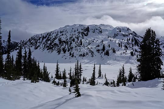 Rainbow Lake 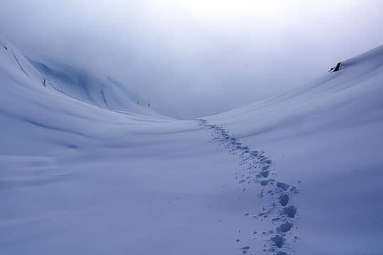 Rainbow Mountain looking down my track 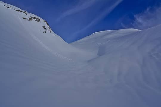 Rainbow Mountain looking up from around 6500ft 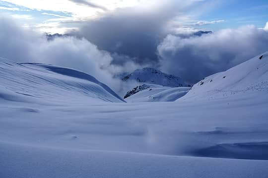 Rainbow Mountain 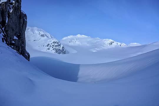 Rainbow Mountain at the bottom of the glacier 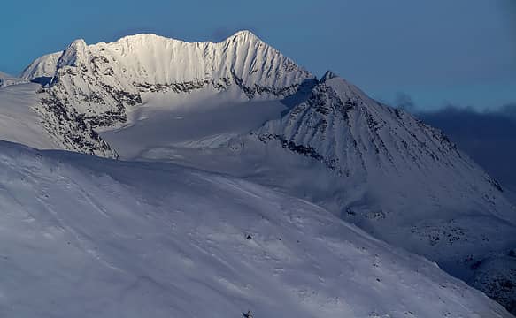 Mount Weart 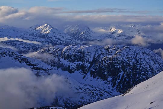 View north the Soo River drainage to the Pemberton Icefield 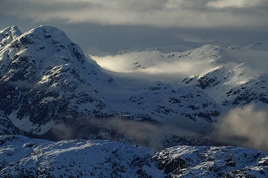 Numbers Peak and Pemberton Icefield in the clouds 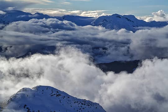 Powder Mountain area 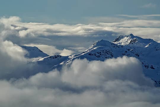 Hidden Peak and Mount Callaghan 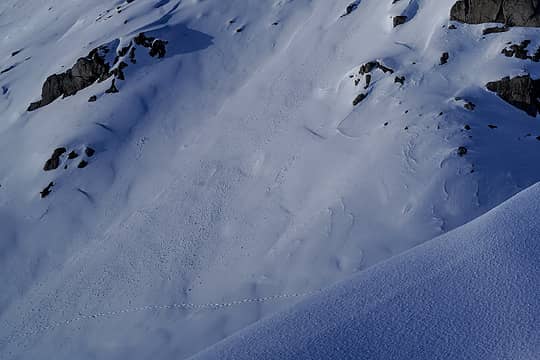 Track on Rainbow Mountain 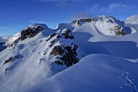 Rainbow Mountain SW ridge 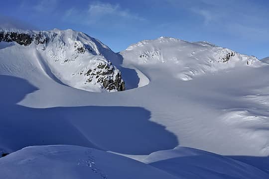 Rainbow Mountain SW ridge 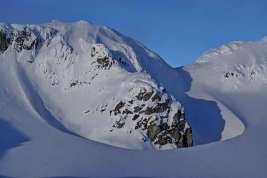 Rainbow Mountain wind scoop 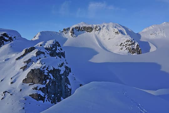 Rainbow Mountain SW ridge 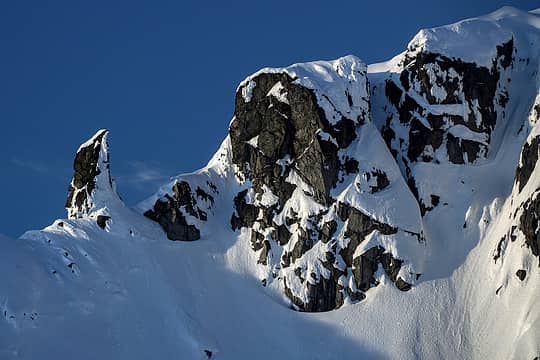 Rainbow Mountain SW ridge 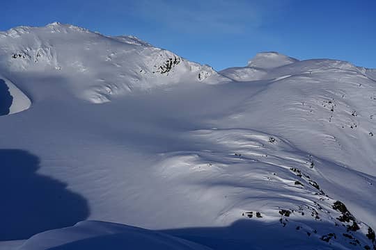 Rainbow Mountain glacier 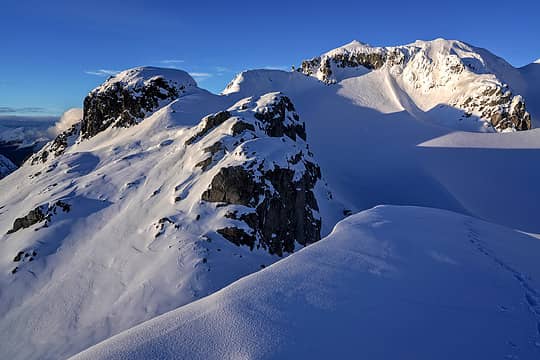 Rainbow Mountain SW ridge 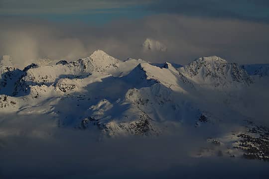 Spearhead, Blackcomb and Tremor Mountain in the background 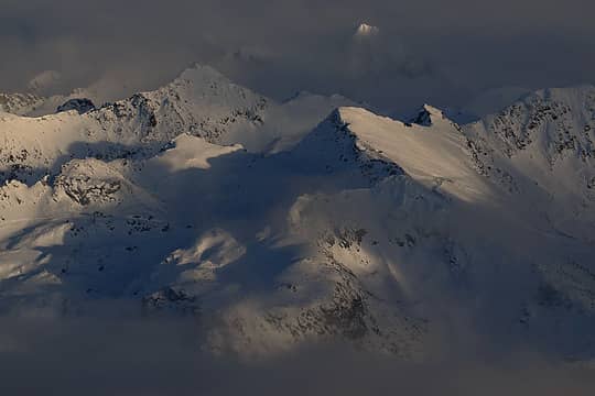 Spearhead and Tremor Mountain in the background 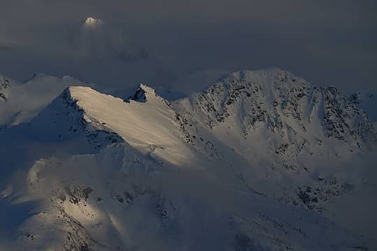 Spearhead, Blackcomb and Tremor Mountain in the background 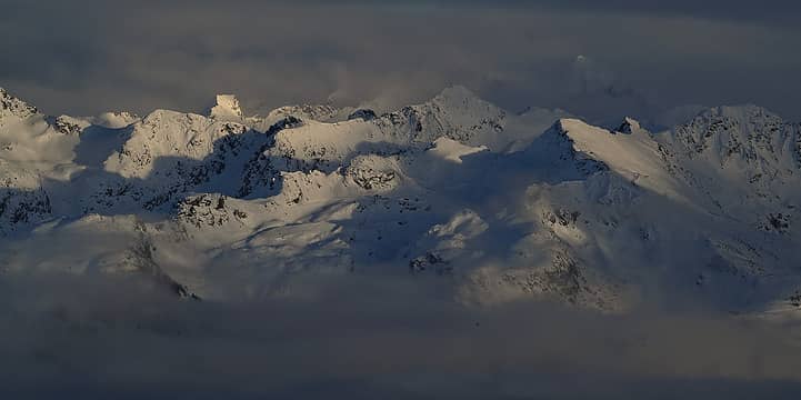 Spearhead panorama at sunset from Rainbow Mountain 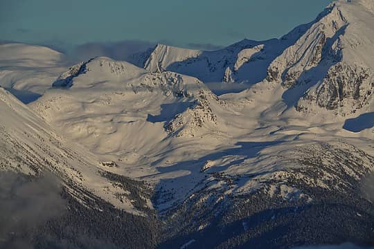 Parkhurst Mountain 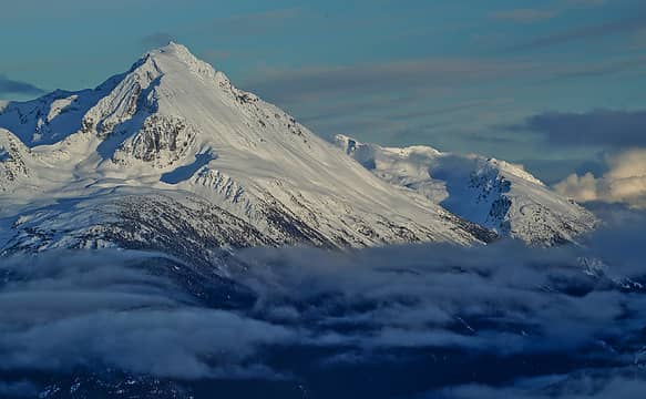 Wedge Mountain 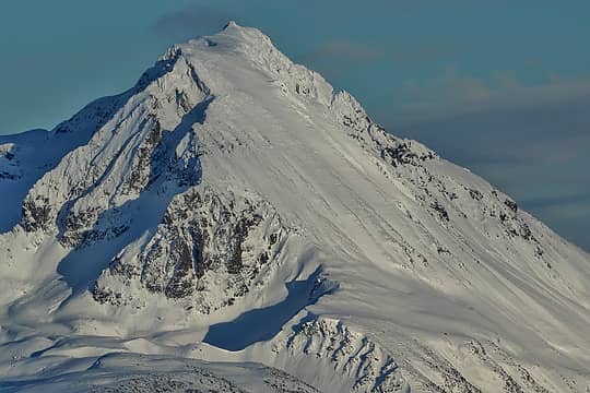 Wedge Mountain 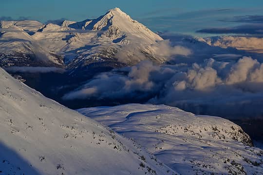 Wedge Mountain 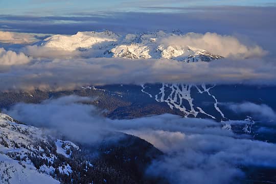 Blackcomb area 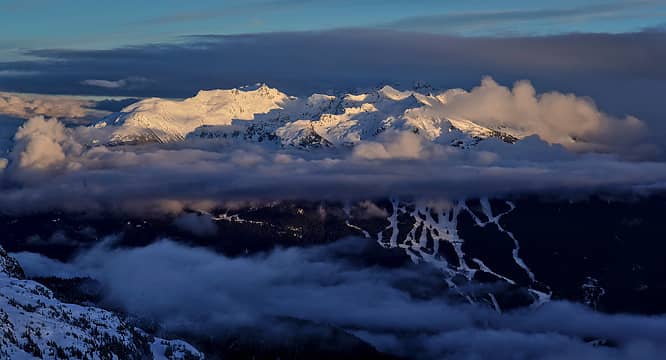 Blackcomb area sunset 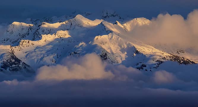 Spearhead and Blackcomb area 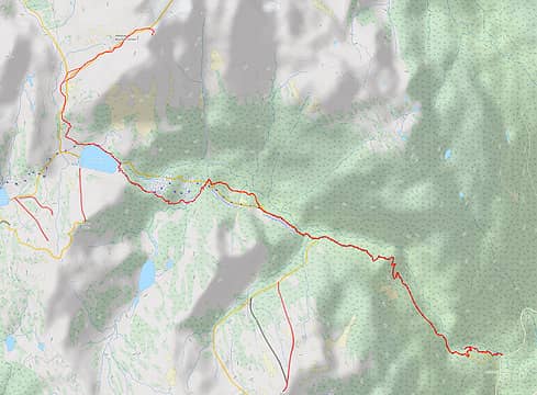 Rainbow Mountain GPS track (17 miles, 5000ft gain)
 call-151, Prosit, Pef, BarbE, awilsondc, fourteen410, John Mac, raising3hikers, Route Loser call-151, Prosit, Pef, BarbE, awilsondc, fourteen410, John Mac, raising3hikers, Route Loser  RichP, Now I Fly RichP, Now I Fly  geyer, rubywrangler, Gimpilator geyer, rubywrangler, Gimpilator
call-151, Prosit, Pef, BarbE, awilsondc, fourteen410, John Mac, raising3hikers, Route Loser RichP, Now I Fly geyer, rubywrangler, Gimpilator |
| Back to top |
  
|
|
raising3hikers
Member
Joined: 21 Sep 2007
Posts: 2344 | TRs | Pics
Location: Edmonds, Wa |
Thanks for the TR, this pk has been on my radar
Eric Eames
mbravenboer
Eric Eames
mbravenboer
|
| Back to top |
|
|
Now I Fly
Member
Joined: 07 Jun 2018
Posts: 473 | TRs | Pics
|
Simply stunning photography! Just beautiful!
|
| Back to top |
|
|
seawallrunner
dilettante

Joined: 27 Apr 2005
Posts: 3309 | TRs | Pics
Location: Lotusland |
7 / 35 could be Mount Fee.
Gimpilator
Gimpilator |
| Back to top |
|
|
puzzlr
Mid Fork Rocks

Joined: 13 Feb 2007
Posts: 7220 | TRs | Pics
Location: Stuck in the middle |
|
puzzlr
Mid Fork Rocks
|
 Mon Feb 26, 2024 5:35 pm |
|
|
This an absolutely massive wind feature. That must have been quite the storm!
| mbravenboer wrote: | Rainbow Mountain wind scoop |
|
| Back to top |
|
|
|
|
You cannot post new topics in this forum
You cannot reply to topics in this forum
You cannot edit your posts in this forum
You cannot delete your posts in this forum
You cannot vote in polls in this forum
|
Disclosure: As an Amazon Associate NWHikers.net earns from qualifying purchases when you use our link(s). |


