Forum Index > Trip Reports > Coquihalla, Jim Kelly, and Illal (BC), 9/16-17/2023
 Reply to topic
Previous :: Next Topic
Author Message
Matt
Tea, Earl Grey, Hot


Joined: 30 Jan 2007
Posts: 4308 | TRs | Pics
Location: Shoreline
Matt
Tea, Earl Grey, Hot
PostSat Feb 03, 2024 11:43 am 
catching up on trips from last summer... Dates: September 16-17-2023 Destination: Coquihalla 7077, Jim Kelly 6913, Illal 6562 (British Columbia: Okanogan-Similkameen) Party: Carla, Don, Matt Short Version: We hiked up the Illal Creek trail and camped near Illal Lake. Illal meadows had gorgeous fall colors. The weather was mostly clear, but very windy. The NW ridge of Jim Kelly was a junky rock slope, but had a bit of a beaten path the whole way. For Coquihalla, we traversed below talus slopes around the south side, then ascended a ridge amid some scrubby trees to the summit. Illal had a great view Illal meadows and of the Coquihalla Pass area, but was fiercely windy.
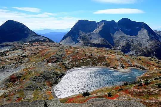
Illal Lake and meadows, Jim Kelly Peak, and Coquihalla Mtn, viewed form Illal Mtn
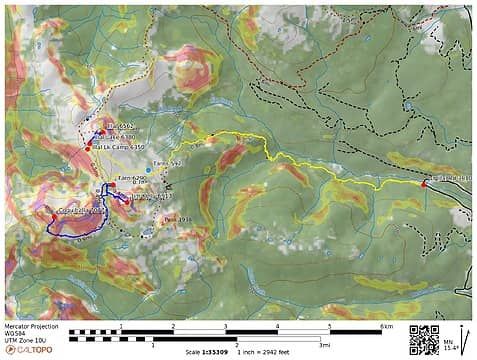
gps tracks
gps tracks
Day 1 Illal Road to Illal Lake Camp The Tullameen road was in very good condition to the junction to the Illal Creek Road, where we parked. The approach hike followed Illal Creek for several miles, then climbed up to beautiful colored meadows. We hiked past the small tarn below Jim Kelly Peak and up to Illal Lake. We set up our camp at a corner just before the lake, because of strong winds blowing across the basin.
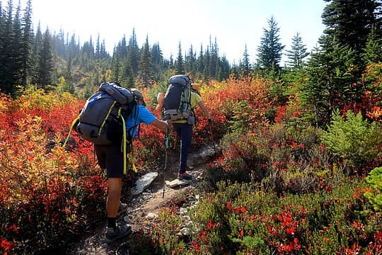
Ascending through increasing colors on the trail.
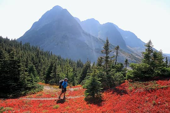
Don hiking across bright meadows below Coquihalla.
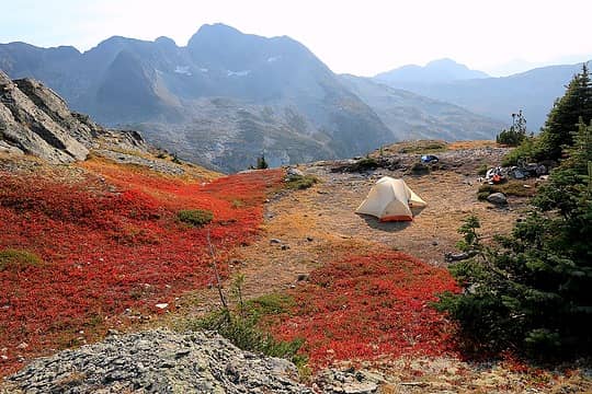
Our camp on a shoulder near Illal Lake.
Illal Road to Illal Lake camp: 6.1 miles, 2780 gain, 250 loss. Jim Kelly Peak 6913 Don and I hiked back to the base of Jim Kelly Peak and scrambled up its northwest ridge. It looks like an endless slope of junk rock and talus, but there is a faint path working all the way up to the summit. The summit had great views back across the meadows to Illal, and through hazy fire smoke to Coquihalla. After descending to the base of the slope, I realized I had left my pack on the summit, so then I had to hurry back up 450 feet to retrieve it. That got me back to camp just as darkness fell for a quick dinner and bedtime to escape the cold wind.
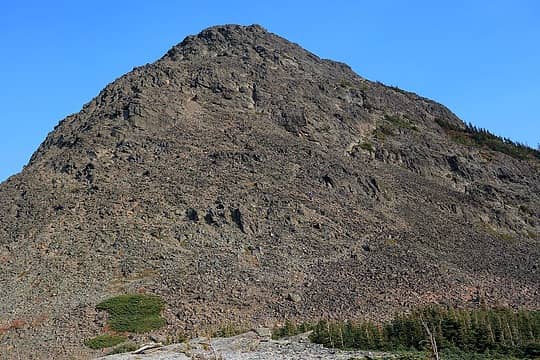
Don on the lower slopes of Jim Kelly
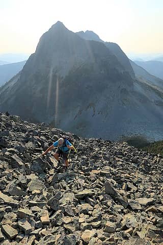
Don arriving at Jim Kelly summit, with Coquihalla behind
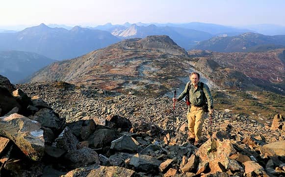
Me at Jim Kelly summit
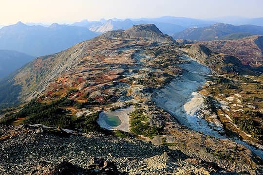
View back down to Jim Kelly tarn and Illal meadows and lake
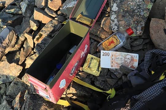
Assorted contents of Jim Kelly summit register
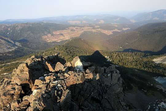
Jim Kelly's shadow at 5:07pm
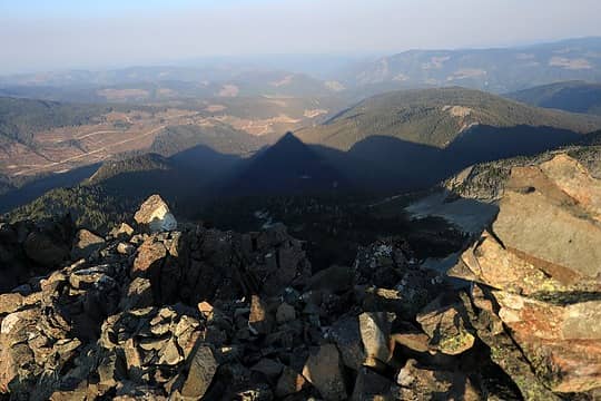
Jim Kelly's longer shadow when I returned to retrieve my pack at 5:55pm
Jim Kelly round trip 2.3 miles, 760 gain. Repeat round trip to summit 0.6 miles, 450 gain. Day 2 Coquihalla Mountain 7077 Morning found our camp socked in, but thin spots overhead gave hope of that higher slopes would be clear. For the easiest scramble up Coquihalla, the key is to hike all the way around the south side of the peak. We hiked trail back to the Illal-Jim Kelly col, then dropped down to the Jim Kelly-Coquihalla col. From there, a way faint trail continued downslope and in meadows then traversed westward below talus slopes. On the talus, there were enough cairns to find the places that we needed to angle higher or lower to avoid steeper parts. We continued till past all the sub-summits till we reached a partially treed ridge below the true summit, and again found just enough of a way trail to follow all the way to the top, discernable by bits of tread, worn spots in the brush, and occasional cairns. This route was all class 2, with maybe a couple easy class 3 moves in a short final gully.
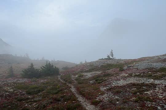
Leaving camp in the fog
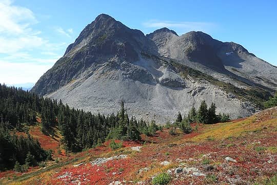
Don't go up anywhere on this side of the peak, instead go through the col at left and traverse around the back
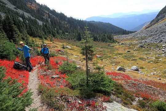
Below the col, where you start traversing around the base of the talus
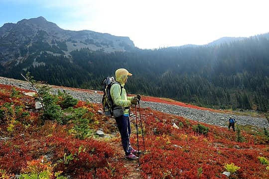
Traversing across bands of talus and meadows
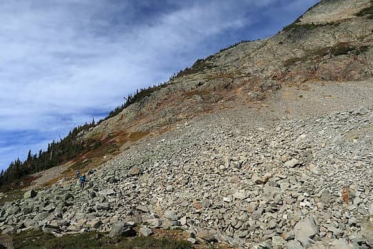
The way trail goes up the treed ridge on the horizon, starting just below the rock band
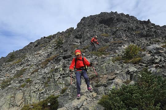
Scrambling near the summit
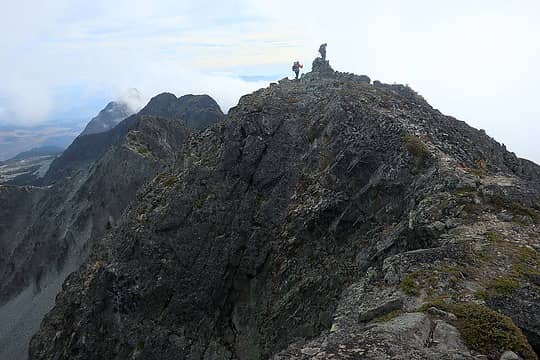
Carla & Don on the summit
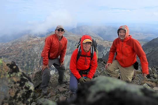
Red jacket day on the summit
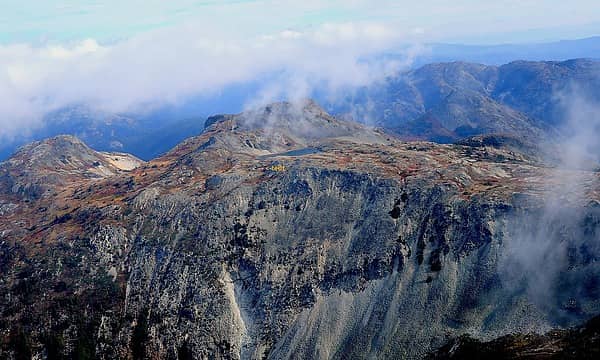
Looking back at our camp perched by Illal Lake
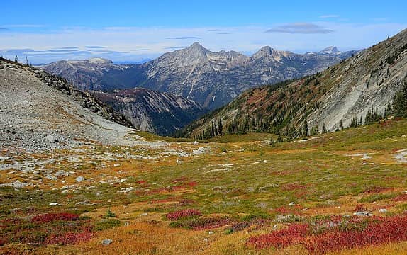
Back at the col, looking northwest to Flatiron, Needle, and Markhor
Coquihalla round trip 4.8 miles, 1850 cumulative gain. Illal Mountain 6562 Back at camp, Don and I made a quick trip up Illal Mtn, following bits of way trail or just wherever terrain looked simplest. The summit was so windy that I had to be carefull not to get blown off the edge while taking photos of beautiful Illal Lake. I had wanted to swim in the lake, but was afraid I'd be blown out to sea and end up somewhere frozen on the far shore.
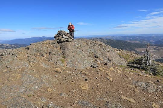
Don on the summit of Illal
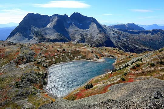
Illal Lake & Coquihalla Mtn from Illal Mtn
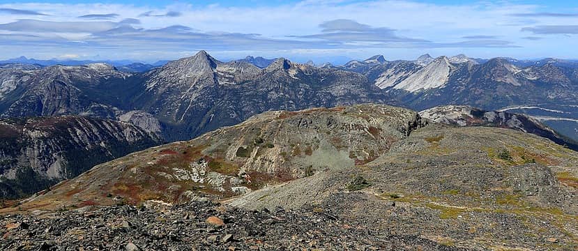
Coquihalla Pass peaks from Illal Mtn
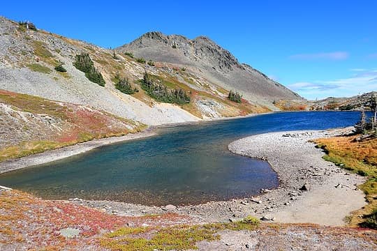
Back at very windy Illal Lake
Illal round trip: 0.9 miles, 230 gain Exit via Illal Meadows For our exit, we angled across the meadows to enjoy more of the beautiful mix of fall colors, white scree, and scattered trees. We rejoined the trail near a pair of tarns at 5900 feet, one of which was calm enough for a swim and picking a few blueberries. As we hiked further down the trail, it was hard to leave the alpine behind, because the high terrain had been so enchanting.
hiking amid the Illal meadows
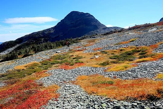
Beauful patches of color amid bight scree
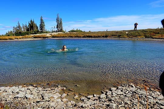
Quick swim in a tarn along the way
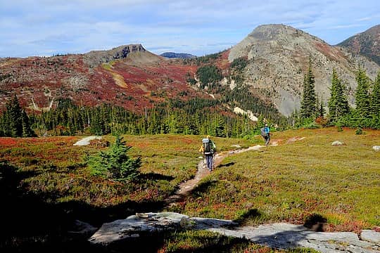
Not wanting to descend and leave the alpine behind.
Exit hike 5.6 miles, 250 gain, 2780 loss. Trip total 20.3 miles, 6320 cumulative gain.

“As beacons mountains burned at evening.” J.R.R. Tolkien

neek, geyer, Waterman, Tom, Gimpilator, John Mac, reststep, RichP, mbravenboer, Now I Fly, fffej50  awilsondc
Back to top Reply to topic Reply with quote Send private message
Gimpilator
infinity/21M


Joined: 12 Oct 2006
Posts: 1684 | TRs | Pics
Location: Edmonds, WA
Gimpilator
infinity/21M
PostSun Feb 04, 2024 2:52 pm 
Beautiful trip Matt. We saw a very large bear on the south side of Coquihalla, maybe a grizzlie. We waited for awhile for it to get well out of the way, before we descended.

Back to top Reply to topic Reply with quote Send private message
   All times are GMT - 8 Hours
 Reply to topic
Forum Index > Trip Reports > Coquihalla, Jim Kelly, and Illal (BC), 9/16-17/2023
  Happy Birthday MFreeman!
Jump to:   
Search this topic:

You cannot post new topics in this forum
You cannot reply to topics in this forum
You cannot edit your posts in this forum
You cannot delete your posts in this forum
You cannot vote in polls in this forum