| Previous :: Next Topic |
| Author |
Message |
rstoddard24
BBQWingz


Joined: 30 Dec 2016
Posts: 74 | TRs | Pics
|
~UPDATE~
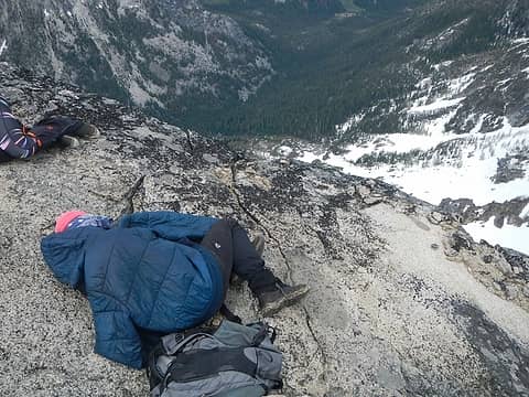
Thanks all for helping me solve the mystery. Here is an annotated photo that clearly shows the change. The only remaining question is for other climbers who climb the new variation comment on if they think the grade changes from 5.4
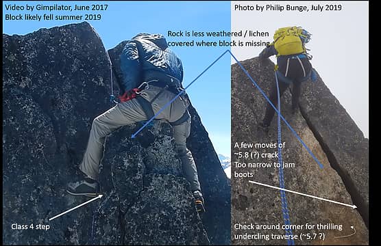 Case Closed! 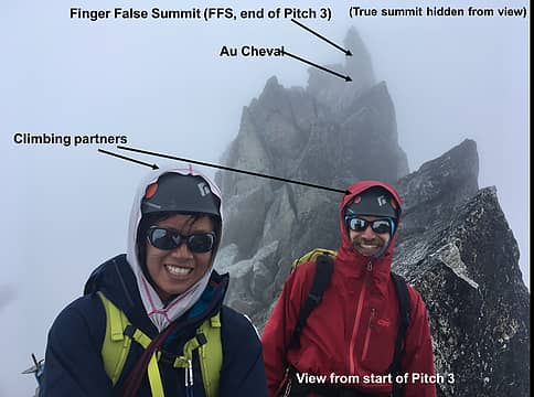 The part of the route in question is after pitch 3, or after you get to the FFS 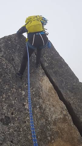 Rebecca rappeling the ~9' crack rock step that looked hard to climb 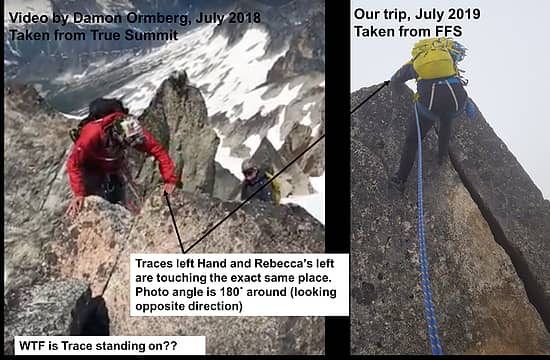 Annotated photo that gets to the heart of the mystery 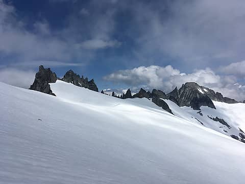 Tepeh towers during a sun break 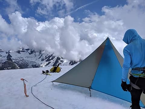 thanks Kim/Liz for the BD Mid!! 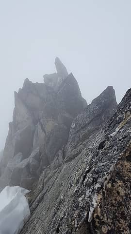 The FFS (Finger False Summit), which is commonly labeled as "Dorado Needle Summit" in some photos 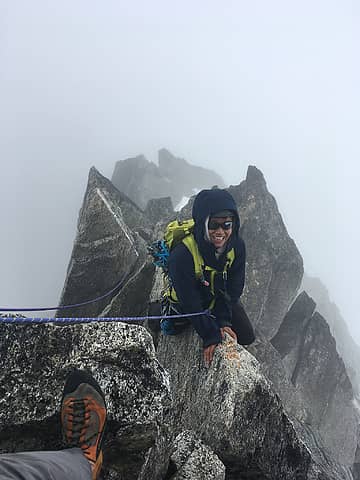 Rebecca thinks the Au Cheval is NBD 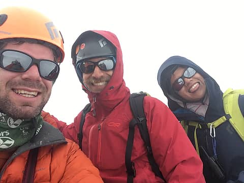 summit! 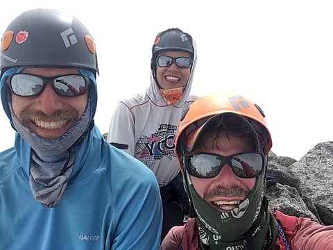 another summit 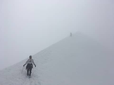 I can't remember where this was taken 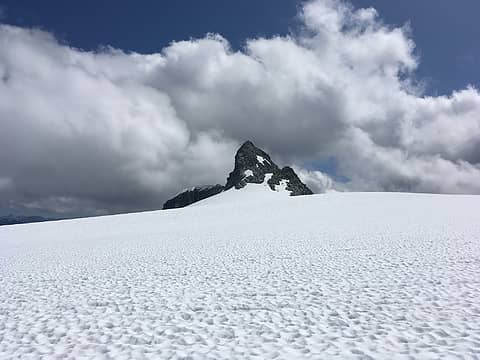 No caption needed 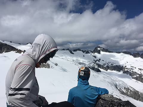 Huge stoke after finally getting The Eggplant 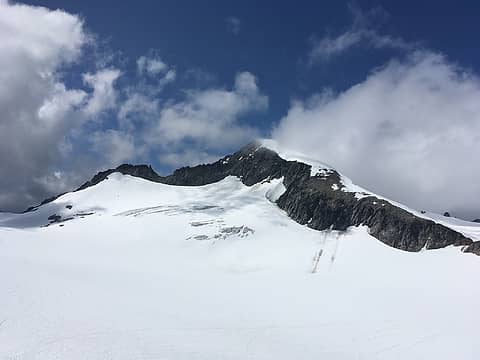 Looking at one of the lesser peaks we climbed on this trip 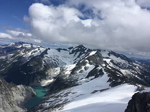 Forbidden! 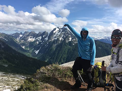 Philip sets his eyes on the J-Berg false summit
|
| Back to top |
  
|
|
Brushbuffalo
Member

Joined: 17 Sep 2015
Posts: 1887 | TRs | Pics
Location: there earlier, here now, somewhere later... Bellingham in between |
| rstoddard24 wrote: | Rebecca rappeling the ~9' crack rock step that looked hard to climb |
Although I haven't climbed this, as a geologist I think that the place directly below Rebecca's right foot shows a distinctly different appearance than the lichen-covered rock to the left and far right.. Although the lichen- free ( or lichen- sparse) rock is still weathered, this could be explained if there was a loose or partially detached block like we see all the time. The space in the joint (fracture) would facilitate surface weathering if not much 'lichenization'. Recently if the block dropped away due to cumulative ice wedging + gravity (hopefully not due to a climber's meager weight!), the piece that Trace might have been standing on in the other picture looking the other direction was that block!
Good observation and detective work!
That will make the summit a bit more challenging, it seems to me!
EDIT: after watching the video, I am 99.9% certain that Trace is standing on a now- absent block! Not to detract from his climbing ability, but note how he just casually steps right over the edge, not what we would expect if he was downclimbing a slanted offwidth.
The block is extinct, absent, gone forever, in the block afterlife, snuffed, is no more ( better quit...now sounding like Monty Python).
Passing rocks and trees like they were standing still
Passing rocks and trees like they were standing still
|
| Back to top |
|
|
rstoddard24
BBQWingz
Joined: 30 Dec 2016
Posts: 74 | TRs | Pics
|
@Brushbuffalo I noticed the differences in rock color too and was thinking the same thing!!
|
| Back to top |
|
|
Stephen B
Member
Joined: 16 Feb 2010
Posts: 108 | TRs | Pics
|
Scott Braswell and I climbed this in a whiteout (C2C, with fog from P1 on up) maybe 3 years ago. I can't tell unfortunately how different your finish was. I do remember that after the au cheval it was quite simple though - even in a whiteout, there was no routefinding and no hard moves. We were roped up still, of course, but I recall it being easy peasy from then on. So, sounds like something broke loose.
|
| Back to top |
|
|
Michael Lewis
Taking a nap
Joined: 27 Apr 2009
Posts: 629 | TRs | Pics
Location: Lynnwood, WA (for now) |
I just reviewed Gimpilator's video of when we were up there on a bluebird day and I can be seen clearly mantling a block in front of that crack that would have been where that light colored face is. There's no doubt in my mind that it did indeed fall away and the climb is more challenging now. Thanks for sharing this. 
|
| Back to top |
|
|
rstoddard24
BBQWingz
Joined: 30 Dec 2016
Posts: 74 | TRs | Pics
|
Thanks @Michael Lewis. For anyone else interested, I believe this is what he is referring to, which clearly shows the missing block. Thanks!!
|
| Back to top |
|
|
Stefan
Member

Joined: 17 Dec 2001
Posts: 5115 | TRs | Pics
|
|
Stefan
Member
|
 Thu Jul 18, 2019 9:25 am |
|
|
Yep, I have been up that move several times. I can see something is missing. First ascent!!
|
| Back to top |
|
|
iron
Member
Joined: 10 Aug 2008
Posts: 6394 | TRs | Pics
Location: southeast kootenays |
|
iron
Member
|
Thu Jul 18, 2019 12:10 pm |
|
|
| Stefan wrote: | | Yep, I have been up that move several times. |
a repeat? say it ain't so!
|
| Back to top |
|
|
puzzlr
Mid Fork Rocks

Joined: 13 Feb 2007
Posts: 7231 | TRs | Pics
Location: Stuck in the middle |
|
puzzlr
Mid Fork Rocks
|
Thu Jul 18, 2019 1:22 pm |
|
|
Darn, I took at least 20 photos in all directions from the Au Cheval to the summit but that is one view I didn't get. I can only think that it was unremarkable after getting past the false finger summit. Thanks for the detailed write-up, and good beta for future climbers.
|
| Back to top |
|
|
gb
Member
Joined: 01 Jul 2010
Posts: 6323 | TRs | Pics
|
|
gb
Member
|
Thu Jul 18, 2019 3:12 pm |
|
|
| Brushbuffalo wrote: | | rstoddard24 wrote: | Rebecca rappeling the ~9' crack rock step that looked hard to climb |
Although I haven't climbed this, as a geologist I think that the place directly below Rebecca's right foot shows a distinctly different appearance than the lichen-covered rock to the left and far right.. Although the lichen- free ( or lichen- sparse) rock is still weathered, this could be explained if there was a loose or partially detached block like we see all the time. The space in the joint (fracture) would facilitate surface weathering if not much 'lichenization'. Recently if the block dropped away due to cumulative ice wedging + gravity (hopefully not due to a climber's meager weight!), the piece that Trace might have been standing on in the other picture looking the other direction was that block!
Good observation and detective work!
That will make the summit a bit more challenging, it seems to me!
EDIT: after watching the video, I am 99.9% certain that Trace is standing on a now- absent block! Not to detract from his climbing ability, but note how he just casually steps right over the edge, not what we would expect if he was downclimbing a slanted offwidth.
The block is extinct, absent, gone forever, in the block afterlife, snuffed, is no more ( better quit...now sounding like Monty Python). |
I agree on the different appearance of the rock, i.e. no lichen on the gold/tan rock next to the crack. I did this particular route in ski boots years ago. That would be pretty difficult now.
|
| Back to top |
|
|
Brushbuffalo
Member
Joined: 17 Sep 2015
Posts: 1887 | TRs | Pics
Location: there earlier, here now, somewhere later... Bellingham in between |
That the block is gone is 100% confirmed by the video of Michael Lewis climbing it.
Now, who has pictures of the summit of Dome before the top fell off, I don't know, maybe about 15 or so years ago?
Maybe that's a new thread that could be fascinating, such as Trigger Finger at Peshastin Pinnacles before and after ( for us old- timers), etc.
Passing rocks and trees like they were standing still
Passing rocks and trees like they were standing still
|
| Back to top |
|
|
rbuzby
Attention Surplus
Joined: 24 Feb 2009
Posts: 1021 | TRs | Pics
|
|
rbuzby
Attention Surplus
|
Fri Jul 19, 2019 9:45 am |
|
|
| Quote: | | Now, who has pictures of the summit of Dome before the top fell off, I don't know, maybe about 15 or so years ago?
. |
The boulder seemingly "placed by a playful diety" (Beckey) on the summit of Dome, was gone by 1993. There is a thread here on NW hikers where that is discussed, from maybe 2010 or so. Did you know Dome is an important mountain? lol.
I will try to dig it up.
|
| Back to top |
|
|
Jake Robinson
Member
Joined: 02 Aug 2016
Posts: 521 | TRs | Pics
|
|
| Back to top |
|
|
iron
Member
Joined: 10 Aug 2008
Posts: 6394 | TRs | Pics
Location: southeast kootenays |
|
iron
Member
|
Fri Jul 19, 2019 9:58 am |
|
|
^ must've been one deep glacier!
|
| Back to top |
|
|
Matt Lemke
High on the Outdoors

Joined: 15 Jul 2010
Posts: 2052 | TRs | Pics
Location: Grand Junction |
|
Matt Lemke
High on the Outdoors
|
Fri Jul 19, 2019 10:09 am |
|
|
| iron wrote: | | ^ must've been one deep glacier! |
Yeah look at that thing...it's a breccia! Completely different rock type than Dome itself. I wonder if Dome used to be somewhat like the Matterhorn in the sense that there were 3-4 different glaciers terminating together in a big ice dome above, ie. on top of where the summit of Dome is today.... 
|
| Back to top |
|
|
|
|
You cannot post new topics in this forum
You cannot reply to topics in this forum
You cannot edit your posts in this forum
You cannot delete your posts in this forum
You cannot vote in polls in this forum
|
Disclosure: As an Amazon Associate NWHikers.net earns from qualifying purchases when you use our link(s). |


