| Previous :: Next Topic |
| Author |
Message |
Fletcher
Member

Joined: 29 Jul 2009
Posts: 1870 | TRs | Pics
Location: kirkland |
|
Fletcher
Member
|
 Tue Sep 16, 2014 10:48 pm |
|
|
I took the day off work Monday to capitalize on the last two days of the nice weather window. Fernow seemed like a good peak to scratch off the list so I decided to go for that. My old childhood friend Tyler wanted to go for a hike over my two days so he decided to come along for the ride. I realized somewhere around Monroe that I had forgotten to pack my camera so all of my pictures in this report were taken with my iPhone.
We were hiking up Phelps Creek by 9am on Monday. The morning air was nice and cool and felt just a little bit like fall. We made good time up into Leroy Basin and refilled on water before starting upslope toward the basin just west of 7 Fingered Jack's summit.
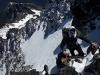
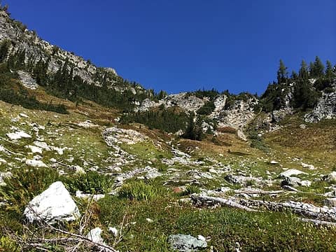 off trail from here 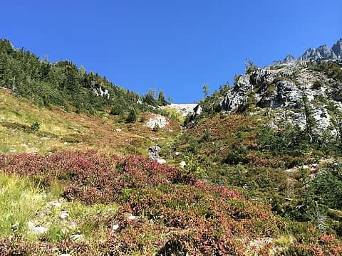 fall color is underway 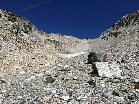 dont go to the saddle on the right, but up and left of the snowfield to stay on route 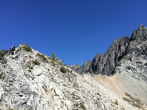 the ridge 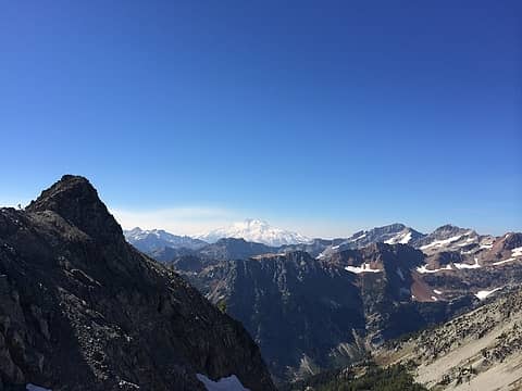 Glacier, Fortress, and Chiwawa from the ridge 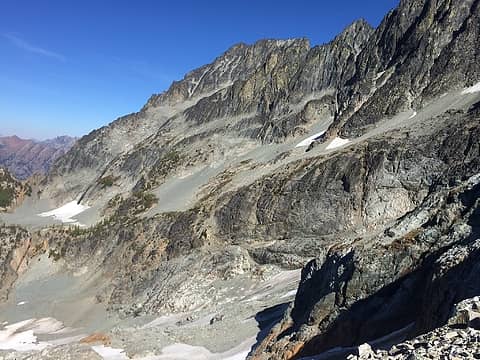 my first look at my route up Fernow 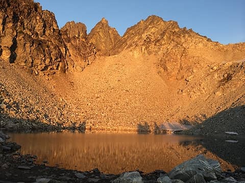 tarn 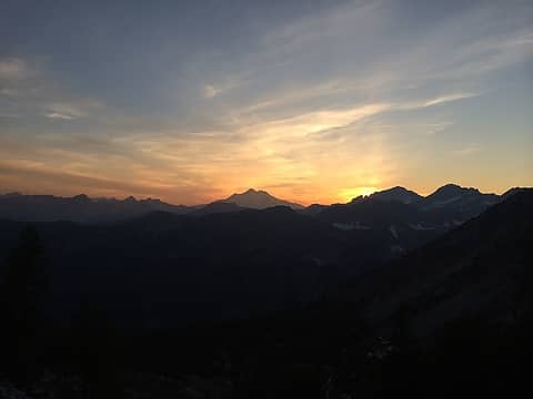 sunset through smokey haze over Glacier Peak 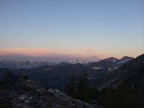 Glacier Peak smokey sunrise 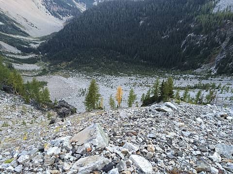 lone yellow larch below the traverse 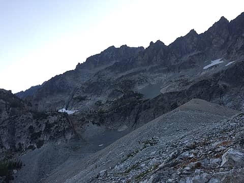 traverse into Gloomy Basin with route up Fernow's waterfall slabs 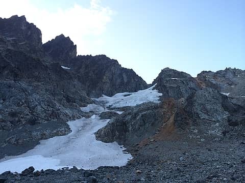 Gloomy Glacier 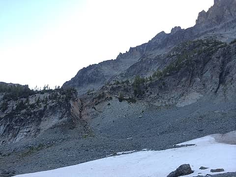 we took the creek up into the upper basin, it went fine although I think there might be an easier route on the right 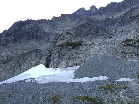 beginning of final Fernow scramble goes up talus and onto the big grass bench then up the right side of the waterfall before being forced to the left by difficult terrain. 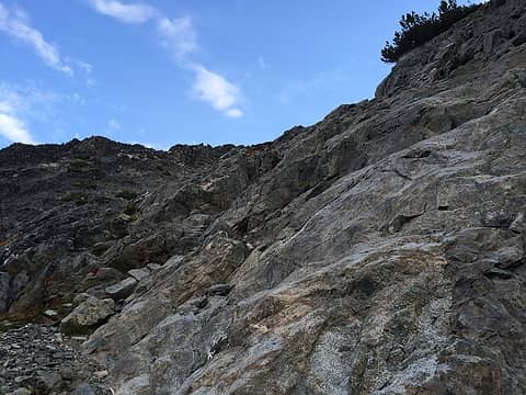 typical terrain up the waterfall slabs 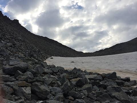 talus basin 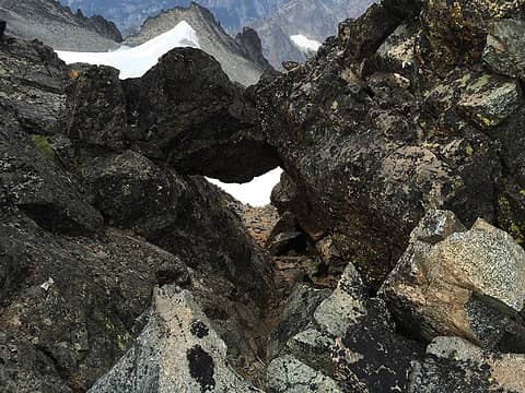 looking down the chockstone 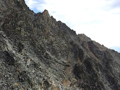 gnarly terrain 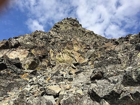 scramble up the summit block 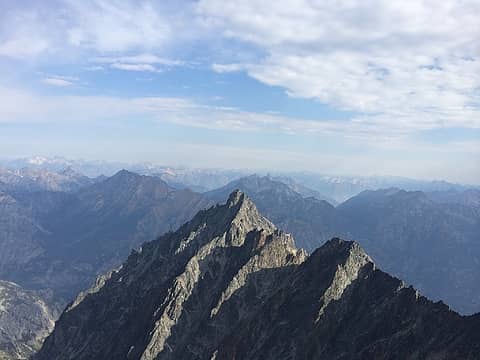 Copper 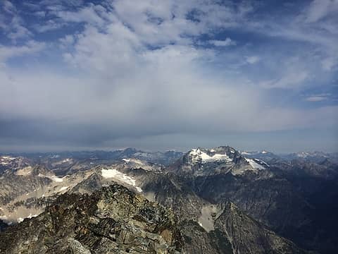 Bonanza among others I am too lazy to name 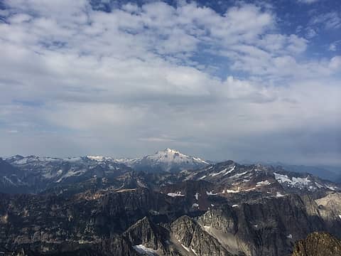 Glacier among others I am too lazy to name 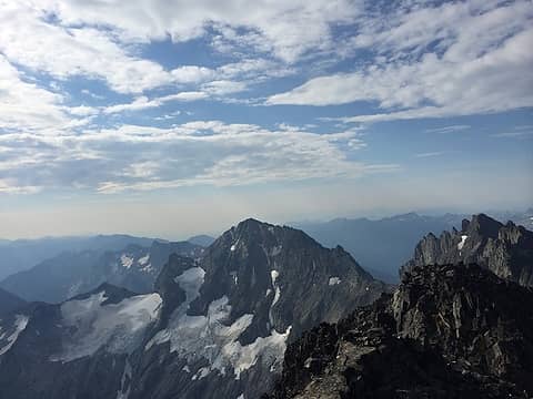 Maude with the Entiat Glacier 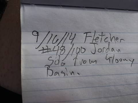 my register entry 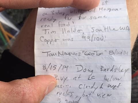 other nwhikers 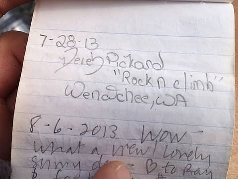 other nwhikers 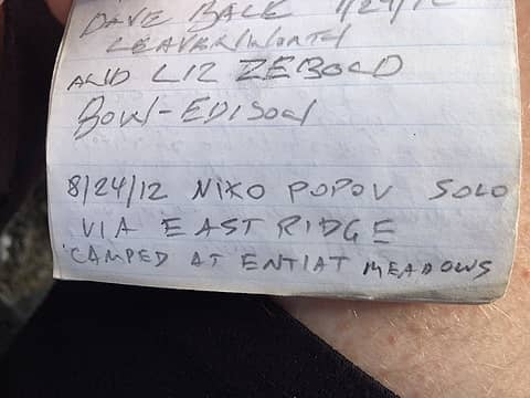 other nwhikers 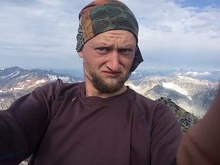 Fernow summitshot 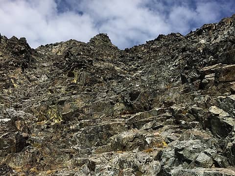 looking back up the scramble 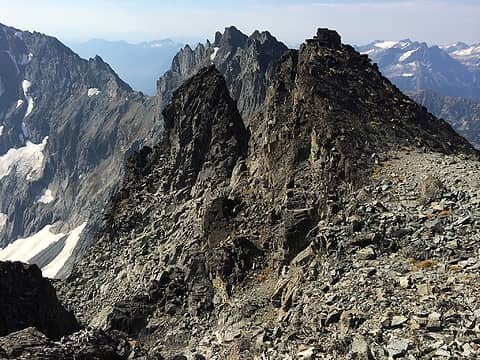 route back to chockstone gully 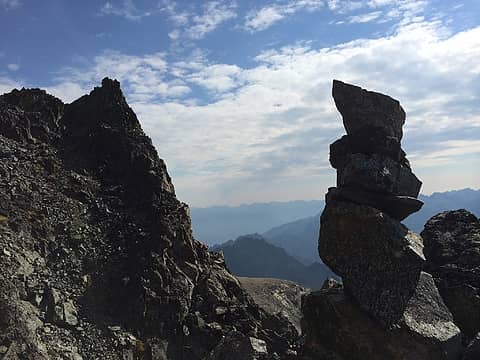 cairn I built to mark my way 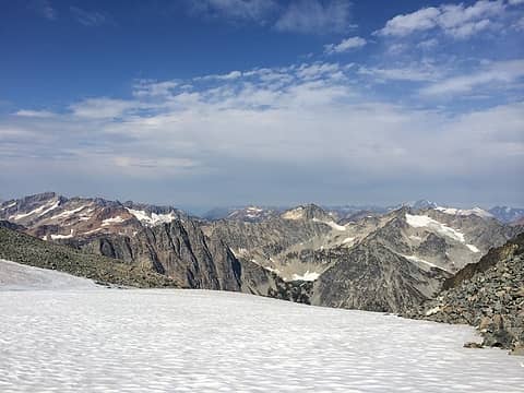 Mt Fernow Sept. 15-16 2014 - 53 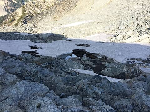 lingering snow above the waterfall slabs 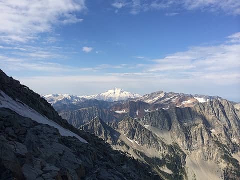 Glacier one more time 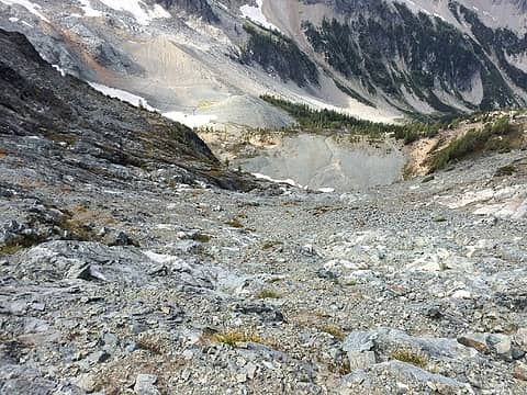 looking down the waterfall slabs, looks intimidating but it really isnt 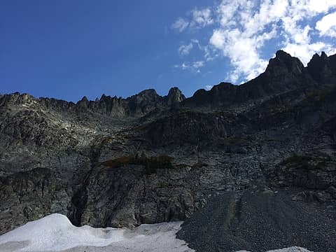 looking back 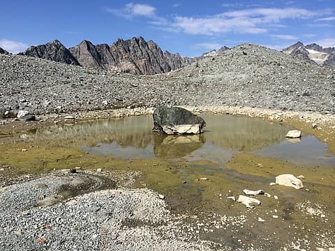 cool tarn in Gloomy Basin 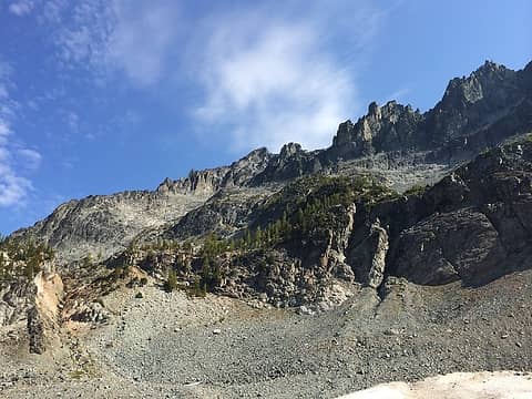 last look back from lower basin 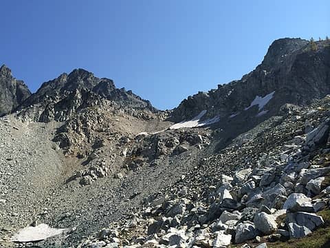 last bit of gain
|
| Back to top |
  
|
|
neek
Member

Joined: 12 Sep 2011
Posts: 2338 | TRs | Pics
Location: Seattle, WA |
|
neek
Member
|
Tue Sep 16, 2014 10:58 pm |
|
|
the iphone certainly gets the point across, and think of the weight you saved!
it's always nice to introduce n00bs to the pleasures of scrambling.
|
| Back to top |
|
|
rocknclimb
Member

Joined: 10 Sep 2010
Posts: 474 | TRs | Pics
Location: Wenatchee Valley |
Sweet trip  I remember that descent into gloomy basin. The snow was rock hard, and we had to front point our crampons for a 100 vertical feet. Glad the lower traverse worked out as well. I remember that descent into gloomy basin. The snow was rock hard, and we had to front point our crampons for a 100 vertical feet. Glad the lower traverse worked out as well.
When asked "Why do you climb"? Simply respond "Why don't you"?
When asked "Why do you climb"? Simply respond "Why don't you"?
|
| Back to top |
|
|
gb
Member

Joined: 01 Jul 2010
Posts: 6311 | TRs | Pics
|
|
gb
Member
|
Wed Sep 17, 2014 6:33 am |
|
|
I did Fernow back in "ol 83". We did it in latter October. Back then there was a good deal more ice. The Gloomy Glacier was, well, a glacier. Now it just looks Gloomy. When we descended (we stayed on a rock rib) into the basin, at the bottom there was a 20 degree or so slope of very hard old ice. We didn't have crampons but probably did have ice axes. There was no hope of being able to walk on the ice. Back in the day we wore wool pants and just scooted along the ice on our butts, the wool pants sticking to the ice.
The upper talus field above the more solid slabs was covered to a degree by a large snowfield which made that part easier. I don't recall going under the chockstone, but maybe it's just that I don't recall that or perhaps there is another way that works. It was none too difficult. Fernow is a nicer route than the standard route on Maude and is way better than talus and scree heap called Seven Fingered Jack.
|
| Back to top |
|
|
GeoTom
Member
Joined: 19 May 2005
Posts: 3215 | TRs | Pics
Location: Earth |
|
GeoTom
Member
|
Wed Sep 17, 2014 8:27 am |
|
|
Much clearer skies than when I went.
|
| Back to top |
|
|
Fletcher
Member
Joined: 29 Jul 2009
Posts: 1870 | TRs | Pics
Location: kirkland |
|
Fletcher
Member
|
Wed Sep 17, 2014 9:47 am |
|
|
| rocknclimb wrote: | | Sweet trip I remember that descent into gloomy basin. The snow was rock hard, and we had to front point our crampons for a 100 vertical feet. Glad the lower traverse worked out as well. |
If I did it again, I would just head straight for that tarn and do the lower traverse all over again. Its fairly pleasant and a lot less dangerous than the more direct route down from the ridge. The elevation gain and loss isnt any different either because you can traverse straight into Gloomy Basin without dropping below it.
|
| Back to top |
|
|
*trace
Member
Joined: 28 Oct 2013
Posts: 80 | TRs | Pics
Location: Maple Falls |
|
*trace
Member
|
Wed Sep 17, 2014 4:24 pm |
|
|
Looks like you went the same way we went earlier in the month. It also appears that my decision to leave crampons and stay low was prudent as well based on your attempted descent. I had the luxury of taking some very zoomed photos from Greenwood right before and it looked very unpleasant anywhere up high. It's a LOT of scree/boulder hopping to go around low but like you said, much safer. Sketchiest part was that dirt slope IMO. The pucker factor on that in running shoes was quite high for me. It is much easier to go around that cone of concreted dirt on the other side and is just more boulder hopping on that side.
Nice work getting up there, and good call on your friends part stopping where the slabs got steep. The rocks get zinging down through there at alarming rates.
|
| Back to top |
|
|
Bedivere
Why Do Witches Burn?
Joined: 25 Jul 2008
Posts: 7464 | TRs | Pics
Location: The Hermitage |
|
Bedivere
Why Do Witches Burn?
|
Wed Sep 17, 2014 7:49 pm |
|
|
Those cement-like moraines are a massive PITA! That route from the tarn down into the basin goes better if you hug the buttress, cutting hard right around the bottom of it to avoid the moraine and stay on talus.
Good work! I have fond memories of my solo trip up there. How far back does the register go? I was there in '08.
|
| Back to top |
|
|
|
|


