| Previous :: Next Topic |
| Author |
Message |
Bernardo
Member


Joined: 08 Feb 2010
Posts: 2174 | TRs | Pics
Location: out and about in the world |
|
Bernardo
Member
|
 Sun Sep 12, 2010 11:52 pm |
|
|
Summary:
Walked around Snoqualmie Mountain via Alpental, Snow Lake, Rock Creek Trail, Middle Fork Trail, Goldmyer Hot Springs, old Cascade Crest Trail to Red Pass, Commonwealth Basin and Guy Peak-Cave Ridge saddle. I enjoyed this trip because it offered many natural wonders, beautiful terrain and a great physical challenge. Approx. 8 hours, 19 miles and 6000 feet of elevation gain.
The Long Version:
Ever since I first looked over Red Pass, Ive wanted to follow the route of the old Cascade Crest Trail down to the Middle Fork Valley. This hike was designed to accomplish that objective and entailed travelling over four saddles/passes to complete a loop around Snoqualmie Mountain.
Due to some responsibilities in town I got a late start, but this was fortuitous as the weather improved later in the day.
The first leg of the journey was from the Alpental TH to Snow Lake to the junction with the Rock Creek Trail. The first saddle is on the ridge dividing Alpental and Snow Lake and the second separates Snow Lake from Rock Creek Valley. I was caught short here when a young couple asked me for some Benadryl, and I wasnt able to produce any. I did provide an insect sting relief towelette from my first aid kit. Although I passed quite a few people on the way up, Snow Lake itself was perfectly quiet and I saw no one else until I reached Goldmyer Hot Springs.
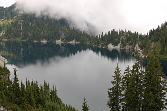 Snow Lake before the clouds lifted 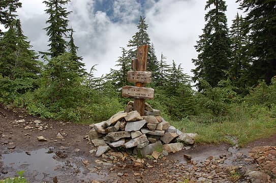 Start of Rock Creek Trail near Snow Lake 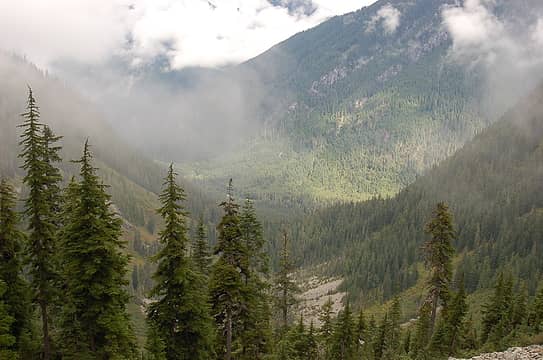 Looking down the valley from near the top of the Rock Creek Trail 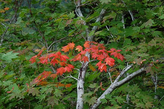 First signs of fall 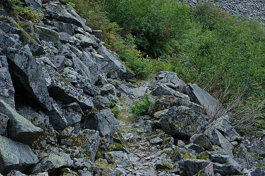 Picture shows both the engineering of the Rock Creek Trail and brush problem 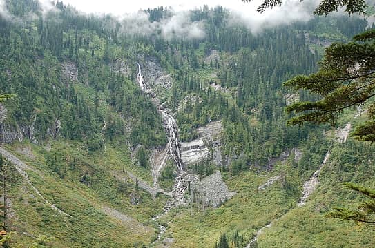 Rock Creek Falls 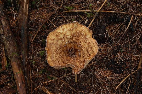 Fungus on the Rock Creek Trail 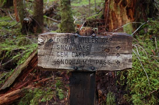 Sign at the intersection of Rock Creek Trail and Middle Fork Trail 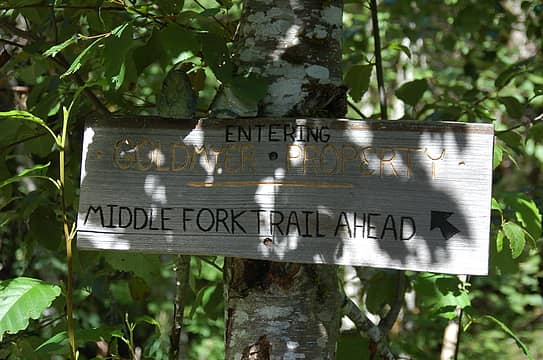 Sign on the north-east bank of Burnt Boot Creek 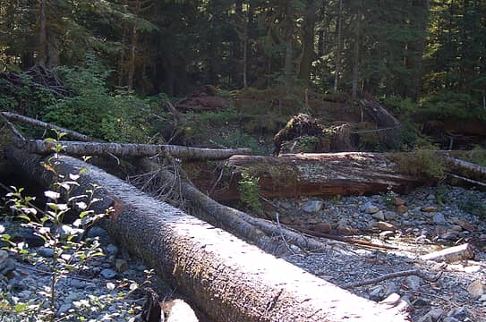 Bridge across Burnt Boot Creek as seen from the north-east bank 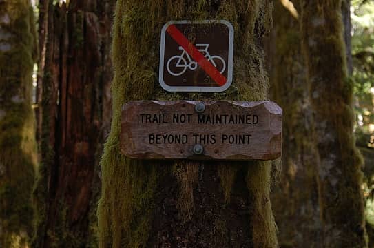 Sign near the bottom of Red Pass (old CCT) trail 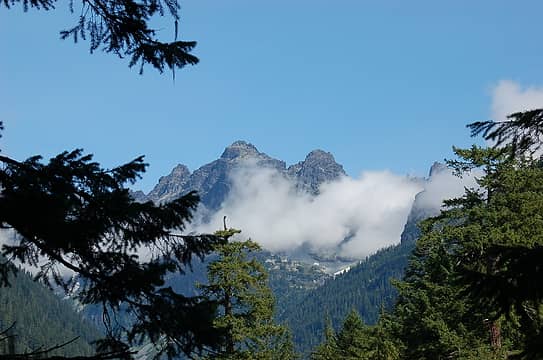 Scenery from the CCT 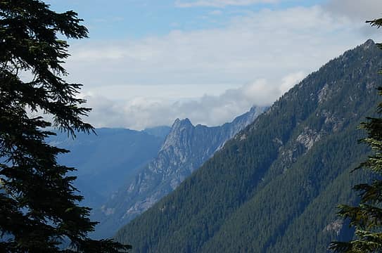 Garfield from the old CCT 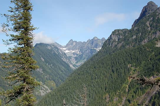 Iceberg Falls 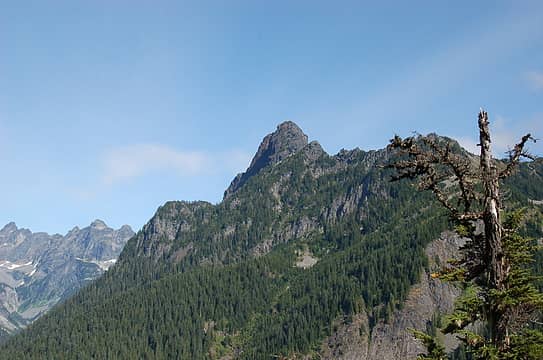 Mount Thompson 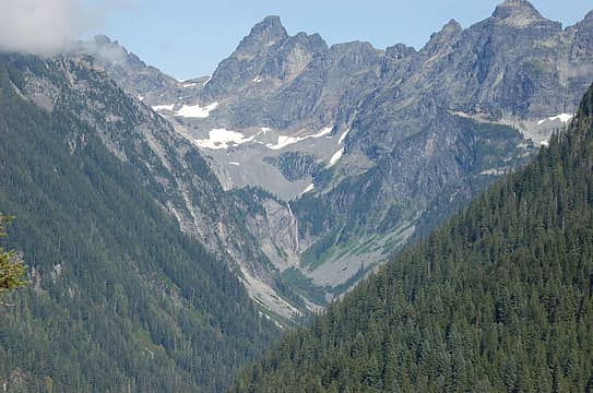 Iceberg Falls, etc.  Red Mountain from the north 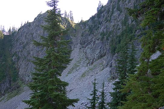 The north side of Red Pass 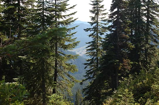 Looking down to I-90 from Red Pass 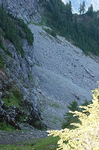 Looking down on the north side of Red Pass 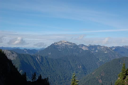 Scenery from Red Pass 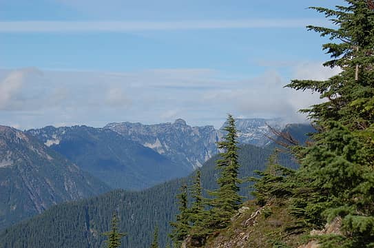 As seen from Red Pass 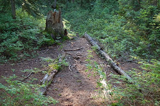 4 Trails intersecting on the Guye Peak Saddle
|
| Back to top |
  
|
|
yukon222
Member

Joined: 12 Mar 2007
Posts: 1895 | TRs | Pics
|
|
yukon222
Member
|
Mon Sep 13, 2010 6:04 am |
|
|
Great loop - I appreciate the fine photos of seldom seen sides of Red, etc since the loss of driving access to the upper part of the Middle Fork. Glad the brush soakings didn't dampen your spirits too much. Thanks for the TR!
|
| Back to top |
|
|
Kat
Turtle Hiker

Joined: 05 Oct 2003
Posts: 2560 | TRs | Pics
|
|
Kat
Turtle Hiker
|
Mon Sep 13, 2010 6:00 pm |
|
|
Did you happen to notice if there is still a trail down to the river where the Rock Creek trail meets the MFK trail?
Several years ago, we drove past Dingford and made the crossing there to start the Rock Creek trail - there was even still a sign there:
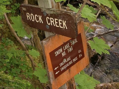 RockCreekSign2
|
| Back to top |
|
|
bdrkayaker
Member

Joined: 17 Oct 2009
Posts: 61 | TRs | Pics
|
Sounds like an awesome trip. Pysched to see a report of the Rock Creek and Red Pass trails. Those shots of the Iceberg outflow waterfall and surroundings are great shots - so tantalizing!
Next time I head up the MF road I'll pack some heat (in the form of clippers that is). Seems like a lot of trails up there are trending to the wild side.
Nothing in the world is more yielding and gentle than water. Yet it has no equal for conquering the resistant and tough. The flexible can overcome the unbending; the soft can overcome the hard. - Lao Tse
Nothing in the world is more yielding and gentle than water. Yet it has no equal for conquering the resistant and tough. The flexible can overcome the unbending; the soft can overcome the hard. - Lao Tse
|
| Back to top |
|
|
Bernardo
Member
Joined: 08 Feb 2010
Posts: 2174 | TRs | Pics
Location: out and about in the world |
|
Bernardo
Member
|
Mon Sep 13, 2010 11:14 pm |
|
|
Kat, I didn't notice the trail going down to the river, but I hope to return to this area soon and will look for it and report back. Unless that sign was on high ground, it probably was washed away in the great flood. Thanks for the information and picture.
bdrkayaker, You keep that up and we'll have to move your comments over to the clipper thread.
Yukon222, I'm looking forward to the opening of the road to Dingford. That will be a big improvement over the current situation with regard to access.
|
| Back to top |
|
|
lopper
off-route

Joined: 22 Jan 2002
Posts: 847 | TRs | Pics
|
|
lopper
off-route
|
Tue Sep 14, 2010 7:25 am |
|
|
Thanks for the report and pics.... it is good to read about the Red Pass CCT back in action.
bdrkkayaker -- has the right idea. Hikers packing heat is how that stretch of scenic trail got reclaimed from oceans of underbrush.
|
| Back to top |
|
|
JimK
Member

Joined: 07 Feb 2002
Posts: 5607 | TRs | Pics
Location: Ballard |
|
JimK
Member
|
Tue Sep 14, 2010 8:41 am |
|
|
Nice report. That's a trip I've thought about. Much thanks to the loppers of the world who keep those old trails hikeable.
|
| Back to top |
|
|
huron
Member

Joined: 13 Sep 2004
Posts: 1056 | TRs | Pics
|
|
huron
Member
|
Tue Sep 14, 2010 8:43 am |
|
|
Another circumnavigation. Nice 
|
| Back to top |
|
|
|
|
You cannot post new topics in this forum
You cannot reply to topics in this forum
You cannot edit your posts in this forum
You cannot delete your posts in this forum
You cannot vote in polls in this forum
|
Disclosure: As an Amazon Associate NWHikers.net earns from qualifying purchases when you use our link(s). |


