| Previous :: Next Topic |
| Author |
Message |
Matt
Tea, Earl Grey, Hot


Joined: 30 Jan 2007
Posts: 4308 | TRs | Pics
Location: Shoreline |
|
Matt
Tea, Earl Grey, Hot
|
 Mon Sep 15, 2014 12:00 am |
|
|
Dates: September 13-14, 2014
Party: Sadie's Driver, Middle E, Matt
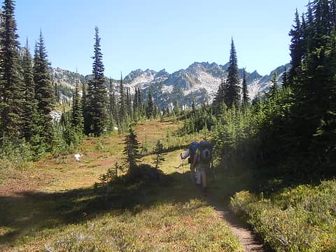
Hiking to camp at Chain Lakes:
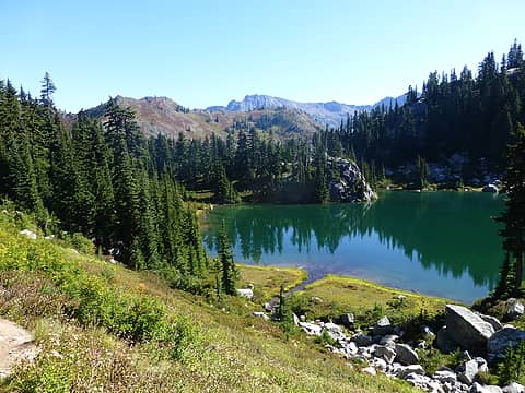
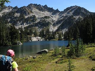 Arriving at Lower Chain Lake; Bulls Tooth real summit is at far left 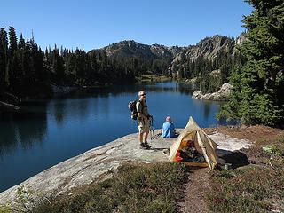 Gorgeous camp on a rock slab at the head of Middle Chain Lake 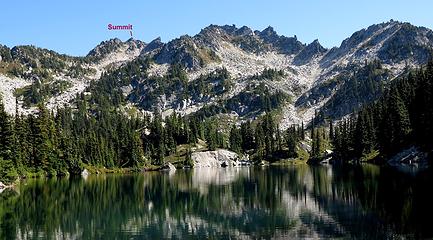 Which one is the summit? 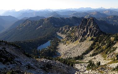 Looking down on Chain Lakes from Bulls Tooth 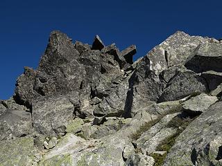 The summit rocks 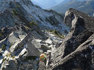 Suzanne arriving near the summit 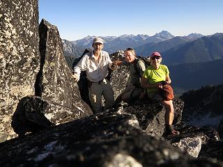 Summit photo 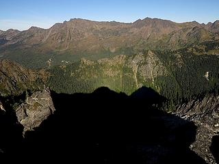 Casting a shadow out toward Chiwaukum & Snowgrass 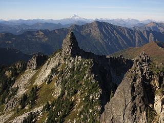 Looking over at the more tooth-shaped summit 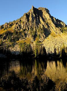 Reflection in Middle Chain Lake 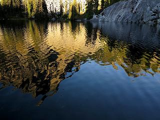 Another reflection 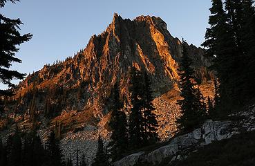 Rocks turning red 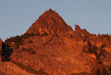 Bright red light on Suzanne's bird-shaped rock 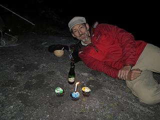 Early birthday celebration 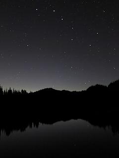 Big Dipper over the lake 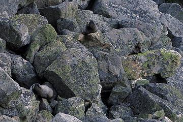 Three marmots 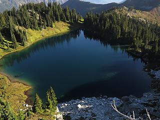 Doelle Lake 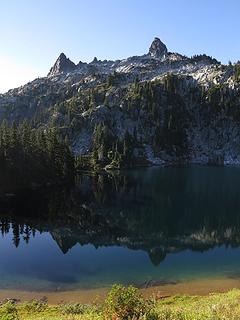 More Doelle Lake 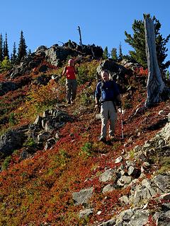 Running the ridge to the true summit 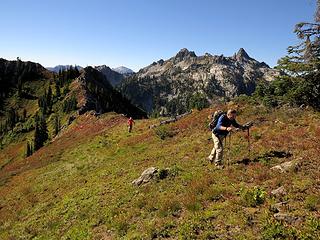 and Bulls Tooth in the background 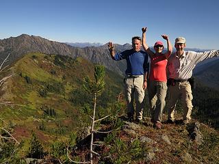 Group photo 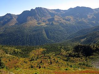 Looking across to Chiwaukum 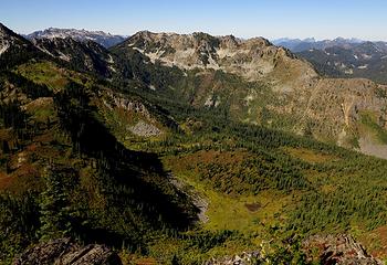 Looking the other way to Lemool 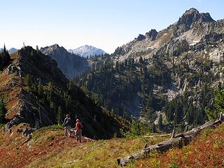 Returning 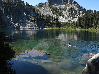 Swimming in Doelle Lake 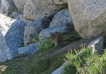 Industrious Pika 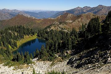 Doelle Lake & Doughgob 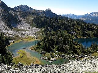 Upper & Middle Chain Lakes 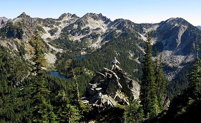 Lemool summit photo
As beacons mountains burned at evening. J.R.R. Tolkien
As beacons mountains burned at evening. J.R.R. Tolkien
|
| Back to top |
  
|
|
HitTheTrail
Member

Joined: 30 Oct 2007
Posts: 5466 | TRs | Pics
Location: 509 |
Nice fall colors.  I love that place and it does not get a lot of traffic (at least not much traffic coming from the Frosty Pass side). Back in the day my wife and I went in there several times. Once on the original trail that went up Doughgod Creek. Too bad that trail has gone back to nature. I love that place and it does not get a lot of traffic (at least not much traffic coming from the Frosty Pass side). Back in the day my wife and I went in there several times. Once on the original trail that went up Doughgod Creek. Too bad that trail has gone back to nature.
|
| Back to top |
|
|
Magellan
Brutally Handsome

Joined: 26 Jul 2006
Posts: 13116 | TRs | Pics
Location: Inexorable descent |
|
Magellan
Brutally Handsome
|
Mon Sep 15, 2014 6:22 am |
|
|
Gorgeous!
|
| Back to top |
|
|
iron
Member
Joined: 10 Aug 2008
Posts: 6392 | TRs | Pics
Location: southeast kootenays |
|
iron
Member
|
Mon Sep 15, 2014 8:50 am |
|
|
looking good matt. that's a beautiful spot tucked in there.
|
| Back to top |
|
|
puzzlr
Mid Fork Rocks

Joined: 13 Feb 2007
Posts: 7223 | TRs | Pics
Location: Stuck in the middle |
|
puzzlr
Mid Fork Rocks
|
Mon Sep 15, 2014 10:36 am |
|
|
Beautiful area. Good to see the fall colors starting.
|
| Back to top |
|
|
chiwakum
not credible

Joined: 29 Jun 2009
Posts: 980 | TRs | Pics
Location: Ballard |
|
chiwakum
not credible
|
Mon Sep 15, 2014 11:26 am |
|
|
|
| Back to top |
|
|
olderthanIusedtobe
Member

Joined: 05 Sep 2011
Posts: 7727 | TRs | Pics
Location: Shoreline |
| Matt wrote: | Three marmots |
Nice capture. All 3 appear to be looking at the same thing.
That's an interesting area. I got in there once many years ago. I sorta had a notion to climb the Bull's Tooth but got confused about which peak was actually it and didn't summit anything.
|
| Back to top |
|
|
contour5
Member

Joined: 16 Jul 2003
Posts: 2965 | TRs | Pics
|
|
contour5
Member
|
Mon Sep 15, 2014 6:57 pm |
|
|
|
| Back to top |
|
|
Sadie's Driver
Sadie's Driver
Joined: 24 Apr 2006
Posts: 1763 | TRs | Pics
Location: Welcome Pass |
| Matt wrote: | | Dates: September 13-14, 2014 Party: Sadie's Driver, Middle E, Matt |
 And now, for the rest of the story - the details that Matt left out!
   I was surprised when Matt said that he had never been to Bulls Tooth or Chain and Doelle lakes. I told him that I would be more than happy to show him the USGS Bulls Tooth the same one identified by Ira Spring and Harvey Manning in the 100 Hikes in the Alpine Lakes (pg. 50) as being Bulls tooth all 6807 of it. Trail Pair, Clover and I found that one Labor Day weekend 2007 Bulls Tooth 2007 . Barry and I went back in 2011 No Bull to do (supposedly) the REAL Bulls Tooth (6840 & where the summit register is) as a day hike and to leave the NW Hikers Traveling Summit Register. Well, the winter winds of 2010 foiled us and after struggling mightily to clamber over/under/around/and through blowdown, we gave up after about 1/10th of a mile from the Icicle Creek crossing. It was overwhelming. Alas, the traveling register didnt make it up there in fact, the last anyone saw or heard of the traveling register was when we put it on Mac Peak and it disappeared.
Anyway, back to this weekends adventure. The three of us agreed to this trip, since Barb, Elle, Ragman and Denali Girl (and Izzy) were headed to Thunder Mountain Lakes and Thor. Since we had just done that trip (plus Thunder Mountain and Nimbus and K-9) the year before, the three of us opted for a new summit for all of us. We met at the Stevens Pass Nordic Center and headed up the Mill Creek Road to where you dont want to go any farther thats just beyond the hairpin (where Matt parked) and where the road starts heading much more steeply uphill. There is a pull out here and one car already was parked there when we arrived. Just north (back down the road) of the hairpin is where you can find the trailhead for the cut-off/connector trail that will dump you out onto the PCT. We actually took a shortcut to the cut-off trail (a little steep) that's closer to the hairpin, but eventually we hooked up with the connector route and soon landed on the PCT where Matt looked for the sign that says Yield To Thru Hikers.
I was surprised when Matt said that he had never been to Bulls Tooth or Chain and Doelle lakes. I told him that I would be more than happy to show him the USGS Bulls Tooth the same one identified by Ira Spring and Harvey Manning in the 100 Hikes in the Alpine Lakes (pg. 50) as being Bulls tooth all 6807 of it. Trail Pair, Clover and I found that one Labor Day weekend 2007 Bulls Tooth 2007 . Barry and I went back in 2011 No Bull to do (supposedly) the REAL Bulls Tooth (6840 & where the summit register is) as a day hike and to leave the NW Hikers Traveling Summit Register. Well, the winter winds of 2010 foiled us and after struggling mightily to clamber over/under/around/and through blowdown, we gave up after about 1/10th of a mile from the Icicle Creek crossing. It was overwhelming. Alas, the traveling register didnt make it up there in fact, the last anyone saw or heard of the traveling register was when we put it on Mac Peak and it disappeared.
Anyway, back to this weekends adventure. The three of us agreed to this trip, since Barb, Elle, Ragman and Denali Girl (and Izzy) were headed to Thunder Mountain Lakes and Thor. Since we had just done that trip (plus Thunder Mountain and Nimbus and K-9) the year before, the three of us opted for a new summit for all of us. We met at the Stevens Pass Nordic Center and headed up the Mill Creek Road to where you dont want to go any farther thats just beyond the hairpin (where Matt parked) and where the road starts heading much more steeply uphill. There is a pull out here and one car already was parked there when we arrived. Just north (back down the road) of the hairpin is where you can find the trailhead for the cut-off/connector trail that will dump you out onto the PCT. We actually took a shortcut to the cut-off trail (a little steep) that's closer to the hairpin, but eventually we hooked up with the connector route and soon landed on the PCT where Matt looked for the sign that says Yield To Thru Hikers.  In a short distance, you are at Lake Susan Jane and stay on the PCT South and head up to reach the Icicle Creek trail #1551.
 Avalanche slope - lots of debris left around here 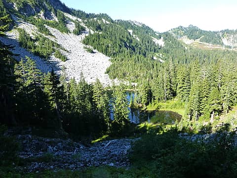 Lake Susan Jane as seen from the PCT 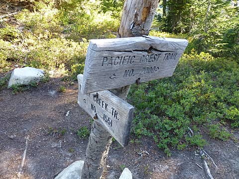 The junction of the PCT and Icicle Creek trail 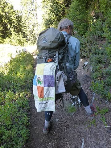 PCT-Turtle looking strong  We were on our own mission passing the tarns just off the PCT and dropping down to Josephine Lake.
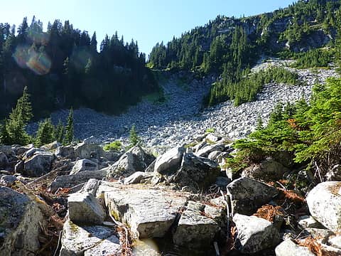
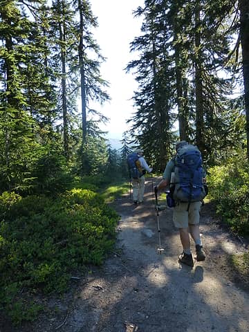 On the Icicle Creek Trail 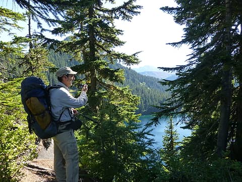 Matt getting a first view of Josephine Lake 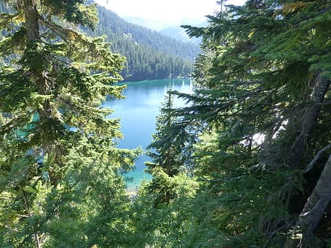 Looking down on Josephine Lake 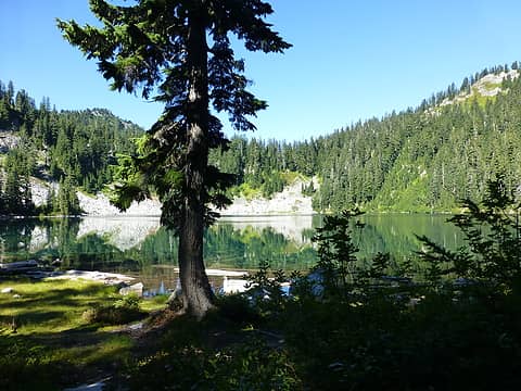 Josephine Lake 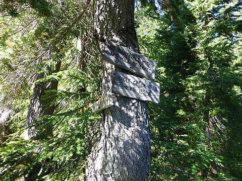 Junction of Icicle Creek and Whitepine trails 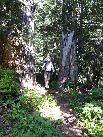 Man among the tall timbers 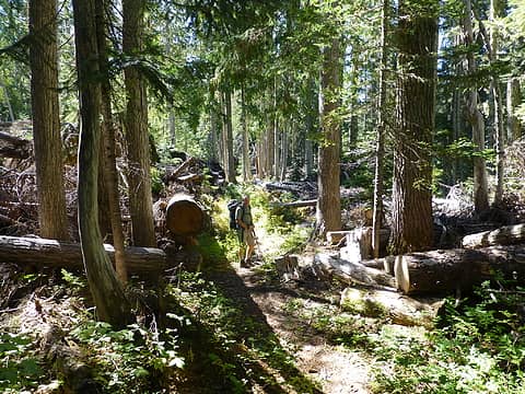 Now I understand why we had a tough time getting through here in 2011 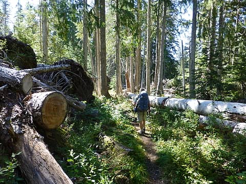 A mess left by the 2010 windstorm 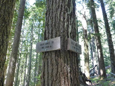 The 1800' climb from Icicle Creek starts here  Donkey butt 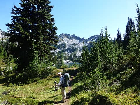 Heading into the Chains 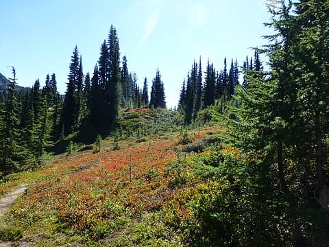 The colors, they are a changin' 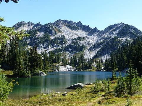 No words needed 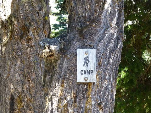 Just in case you couldn't tell 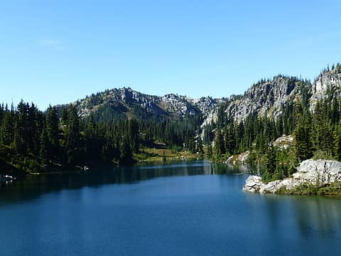 Chain Lake #2 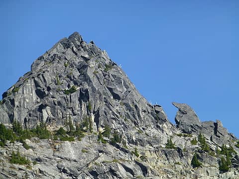 That bird on the right was there in 2007, too - still looks pretty healthy 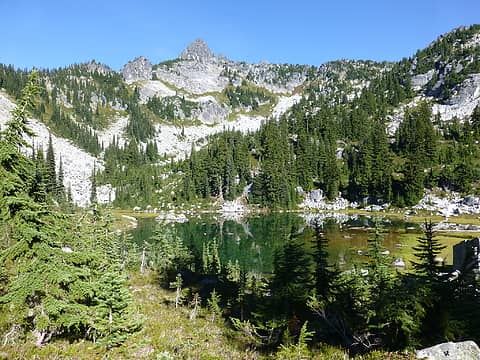 Chain Lake #3 - the shallowest of the three 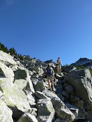 Boulder hopping 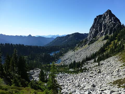 Looking back down at Chain Lakes - from near base of summit block 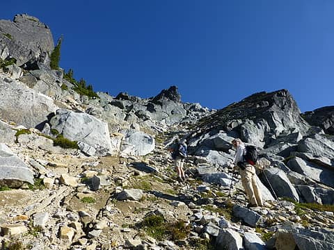 This way . . . they think 
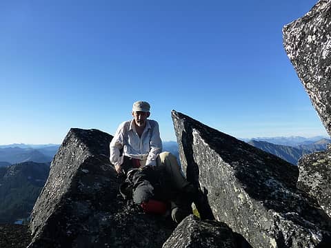 Matt on the summit of Bulls Tooth (actually - the rock on the right side of this photo is the tallest point - I didn't get a shot of Matt on top - darn) 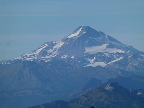 Glacier Peak zoom 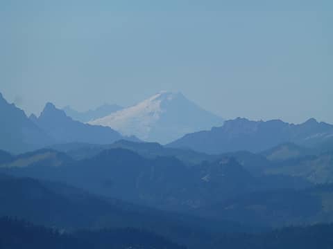 Mt. Baker zoom from top of Bulls Tooth 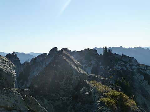 Looking across from the 6840' summit to the 6807' USGS summit of Bulls Tooth (to the southwest) 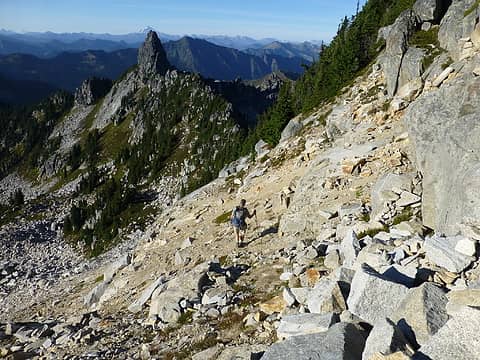 Barry heading down the "obvious" gully 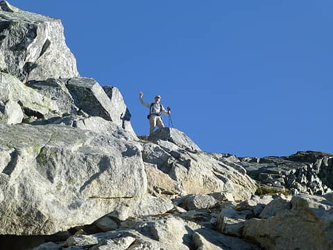 Matt at the base of the Bulls Tooth summit block 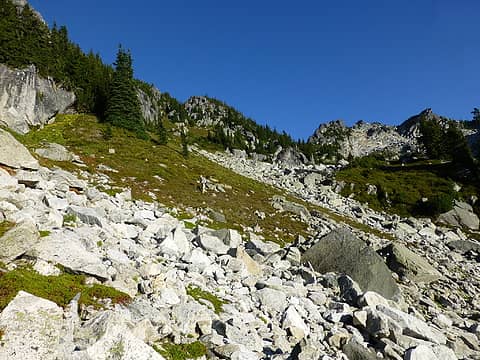 Matt coming down the heather and boulder fields from Bulls Tooth 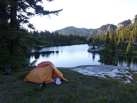 Tent with a view 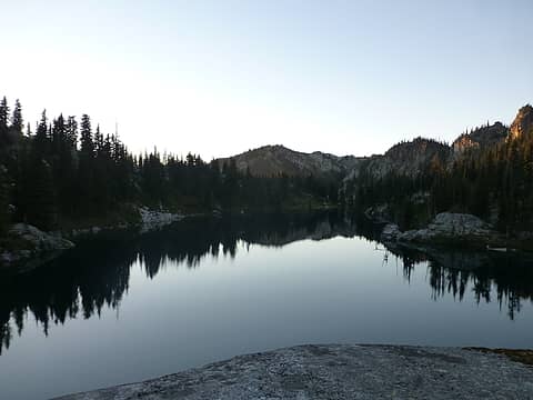 Evening reflection 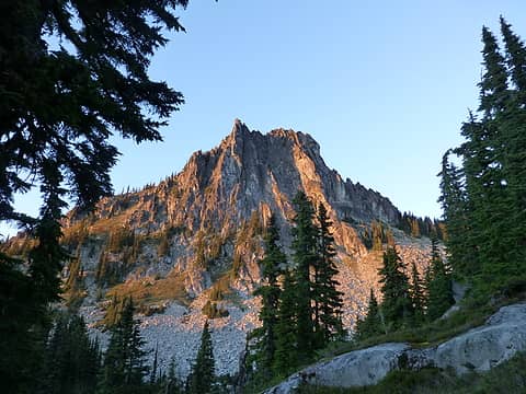 Last of the sun for today on Pt. 6604 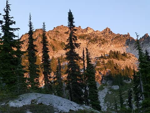 Fading light on Bulls Tooth Ridge 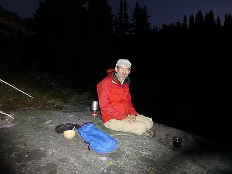 Dinner time 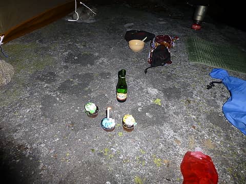 Party table 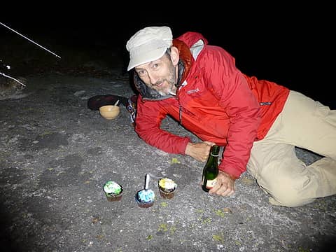 Matt celebrating a #55 a little early 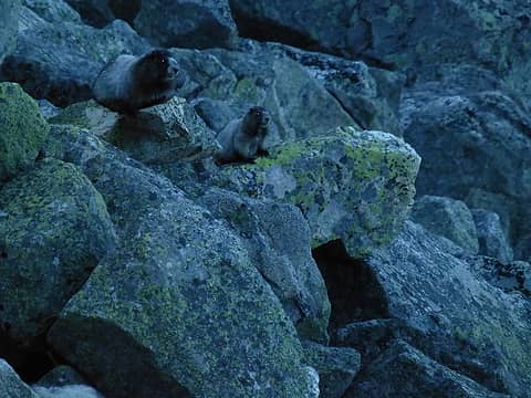 Chubby Marmots on the rocks in the early morning (before the sun hits) 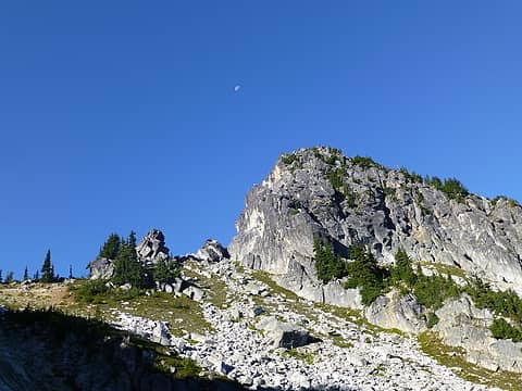 Moon above Point 6604 on the Bulls Tooth Ridge 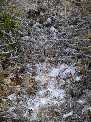 Ice crystals on the trail as we head down from the Bulls Tooth ridge 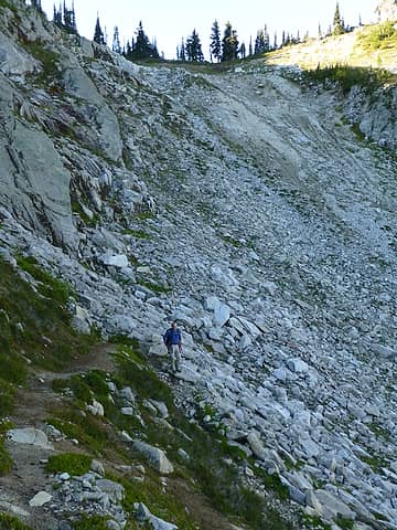 Barry (im)patiently waiting for the shutter bugs 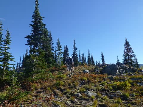 Matt and Barry heading up the Doughgob west ridge 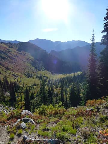 Looking east down the Doughgod Creek drainage 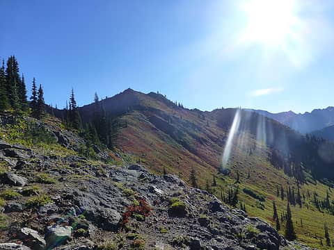 Morning sun on Doughgob 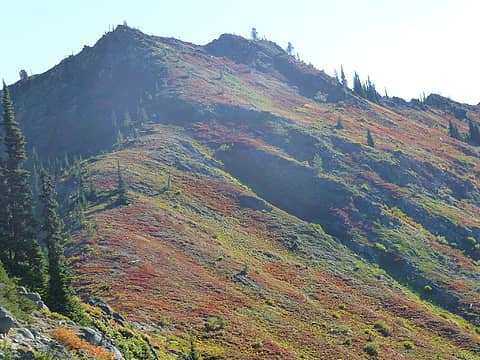 The west ridge leading up to lesser (Doughgirl) Doughgob 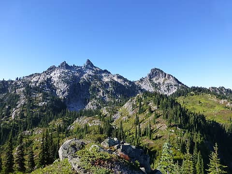 Bulls Tooth Ridge as seen from the Doughgob Ridge 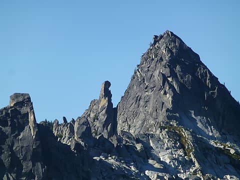 The back of the bird next to what really looks like a tooth! 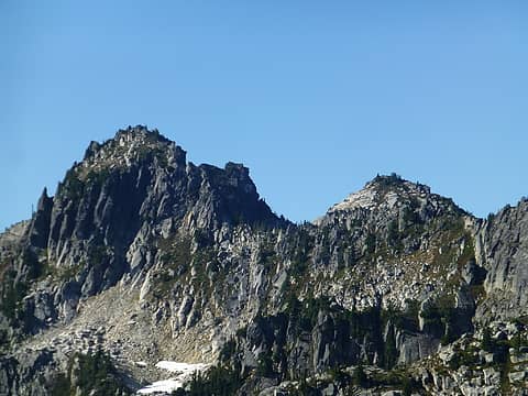 A zoom looking back to Bulls Tooth Ridge 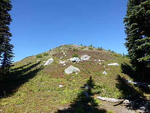 This is the summit of Doughkid 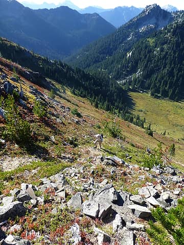 Matt coming up to Doughgirl with Doughgod Creek below 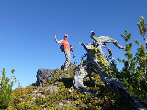 Driver on Doughgirl summit 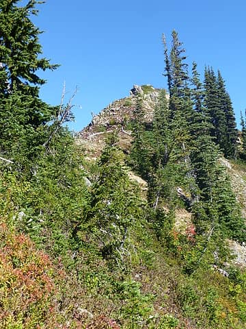 Summit of Doughgob 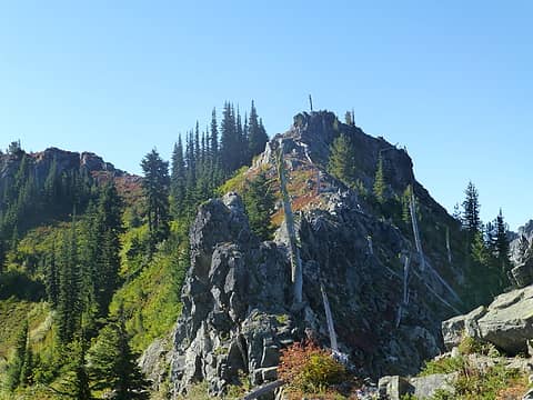 Looking back at the gnarly ridge from Doughgirl to Doughgob 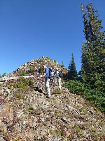 Last little climb to the summit of Doughgob 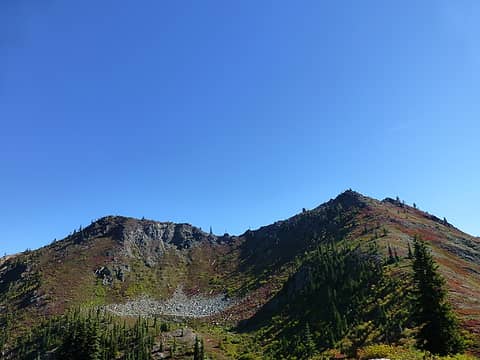 Doughgob summits and ridges - believe it or not, the summit to the left (north) is the highest! 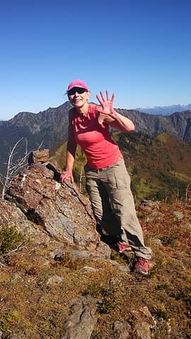 Driver attempting to find a non-existent summit register 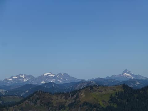 Sloan on the right with his neighbors 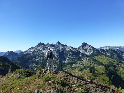 Matt on the Doughgob Ridge looking back to the Bulls Tooth Ridge 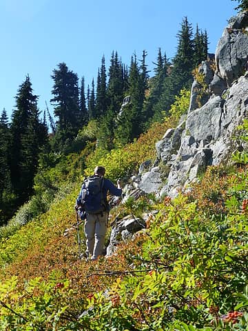 Heading back to Doughgirl from the summit Doughgob  Lower Doelle has a horse camp 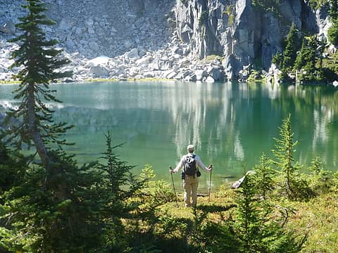 Matt assessing his swimming location  Good luck!
We parted ways with Matt at the Upper Lake so he could take his swim. Good luck!
We parted ways with Matt at the Upper Lake so he could take his swim.
 Looking from the west end of upper Doelle Lake to Doughgob 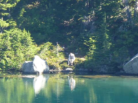 Matt getting ready for his swim in upper Doelle lake   Fun trip as the seasons change color in a beautiful area that doesnt get much traffic - thankfully.
*Obsessive/compulsive/peak bagger syndrome
Fun trip as the seasons change color in a beautiful area that doesnt get much traffic - thankfully.
*Obsessive/compulsive/peak bagger syndrome
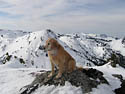
Four-paw buddy lets me tag along!
Four-paw buddy lets me tag along!
|
| Back to top |
|
|
Kim Brown
Member
Joined: 13 Jul 2009
Posts: 6901 | TRs | Pics
|
Matt - no summit tea photo?
We were up there with Torok years ago; we scrambled up something; I thought it might have been Bull's Tooth. I don't know, though ( Isn't this a fascinating post? )
"..living on the east side of the Sierra world be ideal - except for harsher winters and the chance of apocalyptic fires burning the whole area."
Bosterson, NWHiker's marketing expert
"..living on the east side of the Sierra world be ideal - except for harsher winters and the chance of apocalyptic fires burning the whole area."
Bosterson, NWHiker's marketing expert
|
| Back to top |
|
|
Middle E
no more moustache

Joined: 10 Feb 2008
Posts: 432 | TRs | Pics
Location: Seattle, WA |
|
Middle E
no more moustache
|
Wed Sep 17, 2014 6:00 pm |
|
|
| Sadie's Driver wrote: | | there were some naked women in Chain Lake #1 as we went past on our way out Barry didnt notice |
Huh, there was more than one??!!
I have heard numerous tales about the Driver climbing the wrong Bulls Tooth, rivaled only by those about climbing the wrong Thunder Mtn. That said, it was not obvious that we were on the right summit until we were actually standing on it!
 On to the next lake 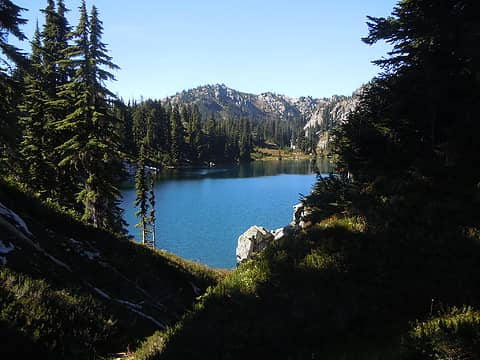 Middle Chain Lk. 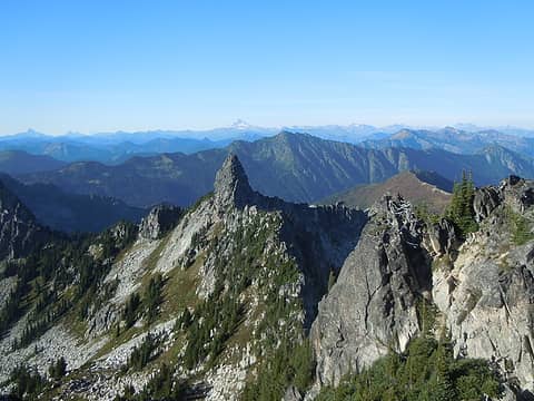 That looks like a tooth 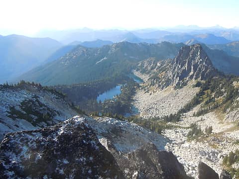 Looking down on Chain Lakes 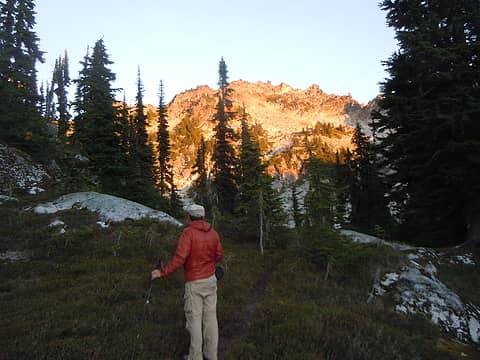 Matt heading off to find color 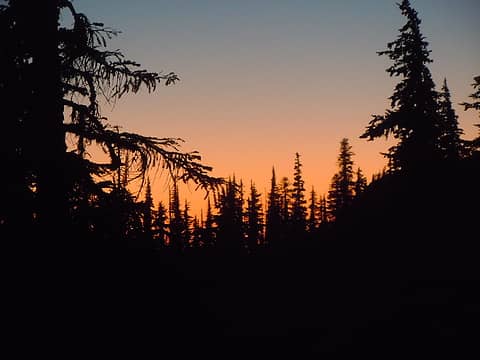 Sunset afterglow 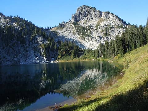 Upper Doelle Lk. and Pt. 6604 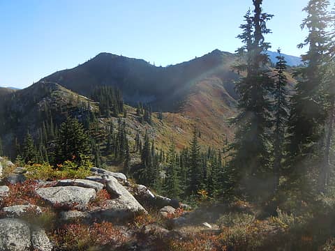 Route to Doughgob 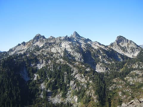 Looking back to Bulls Tooth 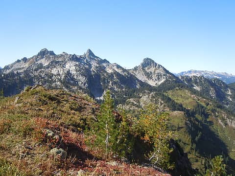 Doughgob summit 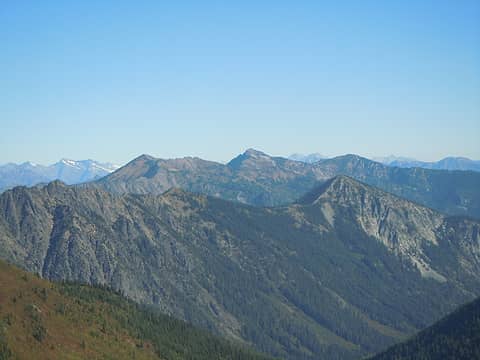 Rock, Howard, Mastiff & Arrowhead 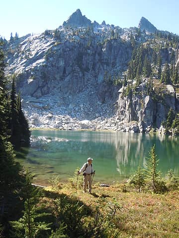 Matt at lower Doelle Lk. 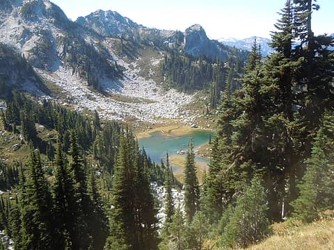 Heading down to Chain Lakes
pithy yet insightful signature
pithy yet insightful signature
|
| Back to top |
|
|
|
|
You cannot post new topics in this forum
You cannot reply to topics in this forum
You cannot edit your posts in this forum
You cannot delete your posts in this forum
You cannot vote in polls in this forum
|
Disclosure: As an Amazon Associate NWHikers.net earns from qualifying purchases when you use our link(s). |


