| Previous :: Next Topic |
| Author |
Message |
Now I Fly
Member

Joined: 07 Jun 2018
Posts: 473 | TRs | Pics
|
This route had been on my mind for quite some time. Stoked by these two reports,
https://www.nwhikers.net/forums/viewtopic.php?p=1208332
https://www.nwhikers.net/forums/viewtopic.php?t=7988790, and Susan Shih's track, I convinced my buddy (Penguin) to give it a go yesterday. One thing I knew for sure was that a Blue Day was required for Price!
We met at the Preston P&R at 7:45 (probably should have met at 6:45). Headed for the Dingford T.H. and were trucking up the trail just before 9:00.
I'd been in the area a couple weeks earlier and had scoped out a few crossing logs for Dingford Creek, so just passed Goat Creek we left the trail and headed S-SE on the best fetches of snow we could find. Wasn't long and we were at the crossing.
After crossing Dingford Creek we loosely followed Susan's track. We were happy to have fair traveling snow on the valley floor. I stuck to my spikes, but my buddy was punching through and switched to his snowshoes. As we climbed out of the valley floor the snow quickly disappeared. We both used spikes as the terrain steepened.
As previously reported, there are cliffs and steep ground to maneuver through. We both thought more snow would have been (mainly) good.
There are two distinct traverses, the first one is the most prominent.
At its end, we took a line requiring a funky tree scramble. Awkward, but it worked well.
Beyond the tree pitch we took a more direct line up the fall line and in short order we were back in good traveling snow (Near 3,800 ft.) At 4,200 you approach a rock feature. Here we worked right (second traverse), then up, to gain Price's NW ridge. By 4,500 we had both switched to snowshoes, as we got into last week's new snow. Maybe up to a foot (plus) of fresh as we neared the summit. Wasn't super easy traveling at that point. Luckly my buddy was pulling a "Beast Mode" and I was able to draft him and save some juice for the final push. Team work!
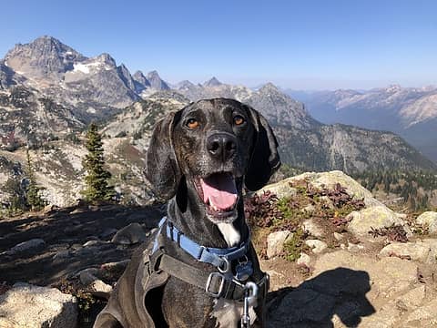
Mount Price's summit is amazing, and I was so glad to be there on a clear day!
I really wish we could have hung around a bit longer, but it was 2:45 and we really wanted to be across the creek before dark so time to boogie!
I think we made it back to the Dingford Creek trail, near Goat Creek, by 5:15. Back to the truck by 7:00(+/-). Only 40 minutes (probably less) in head lamps!
Time, 9:25. Elevation gain around 5,000 (+/-). Distance, 10+ miles.
Spikes & Snowshoes (carried axe's)
And yes, the road still sucks.  Cheers B!
 wallorcrawl, silence, tNguyen, Pef, ALW Hiker, rubywrangler, BarbE, RAW-dad, Fedor, The Ghost of Bear 380, fourteen410, Brucester, Gimpilator, Kascadia, RichP, jsb, neek, zimmertr, Route Loser, John Mac wallorcrawl, silence, tNguyen, Pef, ALW Hiker, rubywrangler, BarbE, RAW-dad, Fedor, The Ghost of Bear 380, fourteen410, Brucester, Gimpilator, Kascadia, RichP, jsb, neek, zimmertr, Route Loser, John Mac  jaysway, awilsondc, KascadeFlat jaysway, awilsondc, KascadeFlat
wallorcrawl, silence, tNguyen, Pef, ALW Hiker, rubywrangler, BarbE, RAW-dad, Fedor, The Ghost of Bear 380, fourteen410, Brucester, Gimpilator, Kascadia, RichP, jsb, neek, zimmertr, Route Loser, John Mac jaysway, awilsondc, KascadeFlat |
| Back to top |
  
|
|
KascadeFlat
Member

Joined: 06 Jul 2020
Posts: 320 | TRs | Pics
Location: Eating peanut M&Ms under my blue tarp |
Yeehaw, big views! Nice work. 
For a good time call: 1-800-SLD-ALDR.
Now I Fly
For a good time call: 1-800-SLD-ALDR.
Now I Fly
|
| Back to top |
|
|
puzzlr
Mid Fork Rocks

Joined: 13 Feb 2007
Posts: 7220 | TRs | Pics
Location: Stuck in the middle |
|
puzzlr
Mid Fork Rocks
|
 Sun Feb 25, 2024 12:16 pm |
|
|
Nice work getting Price in February (even though it's a very unusual one until this week). This answers my question about why you had been up the Myrtle Lake trail recently -- scouting for a log crossing.
BTW, it's "Mount Price" per GNIS
|
| Back to top |
|
|
zephyr
aka friendly hiker

Joined: 21 Jun 2009
Posts: 3370 | TRs | Pics
Location: West Seattle |
|
zephyr
aka friendly hiker
|
Sun Feb 25, 2024 2:42 pm |
|
|
Another excellent report. Thanks for sharing your experience with us.
'Love this part of the ALW. ~z
Now I Fly
Now I Fly |
| Back to top |
|
|
Now I Fly
Member
Joined: 07 Jun 2018
Posts: 473 | TRs | Pics
|
| puzzlr wrote: | | BTW, it's "Mount Price" per GNIS |
Thanks Monty, now I know! I've pointed it out many time over the years but have always just
referred to it as "Price".
Btw, here's my route from the last time up there. Just poking around in so-so conditions. Was pondering a direct line to "Priceless Point", but lost interest somewhere between the nasty uncovered boulder fields, and the heavy snow that began to fall. Set my sites on picking up the Dingford Creek trail and stumbled into the nice log crossing along the way.
The area is a favorite, for sure! Such great trees!
B
|
| Back to top |
|
|
ZenithZephyr
Member
Joined: 05 Feb 2024
Posts: 10 | TRs | Pics
|
Now I Fly |
| Back to top |
|
|
BarbE
Member

Joined: 28 Jul 2006
Posts: 1153 | TRs | Pics
|
|
BarbE
Member
|
Wed Feb 28, 2024 8:41 am |
|
|
Brian & Bryan in Beast Mode! 👍😆
Great summit shots!
Now I Fly
Now I Fly |
| Back to top |
|
|
|
|
You cannot post new topics in this forum
You cannot reply to topics in this forum
You cannot edit your posts in this forum
You cannot delete your posts in this forum
You cannot vote in polls in this forum
|
Disclosure: As an Amazon Associate NWHikers.net earns from qualifying purchases when you use our link(s). |


