Interesting! I've never been able to find the path down off Sam's Peak (SE Peak) before. The path was always easy enough to find, right up until a pretty significant tree fall, close to the cliffs and the river. It always looked to me like the path gets obliterated, and I've never been able to pick it back up again. At this point we usually just "make our own path" back to the main equestrian loop, but I've never seen a path past the treefall. We'll have to try your path. Thanks for posting!
If the image upload ever starts working again I'll upload our GPS recordings. I just tried a half dozen times to attach to this message and keep getting errors.
I really wish I could upload images! I just overlaid your hike recording over mine, and even though I know I was following a trail, it looks like we barely sync up in our hikes! Which means there must be two distinct trails off the peak. Now you've got me interested in exploring again...
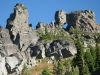
Anyone able to comment on recent quality of the SE summit trail...that is, the 1/2 mile heading south off the well groomed East Ridge trail? trying to take friends less interested in fumbling about than me (i've done it, plus have my own gpx track to use), just asking how overgrown...thanks
You cannot post new topics in this forum You cannot reply to topics in this forum You cannot edit your posts in this forum You cannot delete your posts in this forum You cannot vote in polls in this forum
Disclosure: As an Amazon Associate NWHikers.net earns from qualifying purchases when you use our link(s).