| Previous :: Next Topic |
| Author |
Message |
Bright River
goslowgofar


Joined: 21 Aug 2007
Posts: 223 | TRs | Pics
Location: above the pogonip |
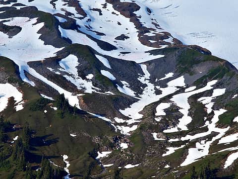
On May 31, I drove up to the TH for Schrieber's Meadow and the Easton glacier - most of the climbing from the south side of Baker. ( The same snow drift that had block the road just short of the TH a month ago was still there although a tree blocking the road had been cut that day.) As usual, the Alpine Ascent vans and MT Baker Ascent van were there, and a total of about 10 cars. 3 parties came out when I was going in; I figured everybody left were likely to be climbers. There had been a lot of climbing parties on Sunday, but only a couple that I could spot on Monday, Memorial Day, before the clouds closed in; and none on Tuesday.
This hike up to Railroad grade is one of my favorites, and I use it often to gauge the snow pack, snow conditions, my knees, and breathing, river fording, rate of climb, equipment and conditioning. This started mostly with an ailing husband who I did not want to leave for long periods. I would tuck him into bed, and lite out for a TH, hike and sleep in the wilderness and under the stars, get up early and be back home before he was up in the morning ( he slept very soundly). One year I decided that I would do one overnight a week, About half the year these were done mostly in darkness.( Because I live in the mountains and near Mt Baker there are lots of THs that I can access in an hour). Also this allows me two days of hiking ( saves on knees) and most of two days at home. Habits die hard.
There was spotty snow at the TH, and about 1/3 of the trail had snow for the first hour or until the river crossing at Rocky Ford( up to my knees and swift for a little bit); most of the switchbacks and climbing above the ford were snow free; then I hit snow pack about 20 minutes before topping out into the lower alpine basin that has the lateral moraine on the East( Railroad Grade) and the Survey Point on the south and Park Butte on the West.
The snow was soft but consolidated - generally I like to find some tracks going up so there is less effort- going down I find that plunge stepping is easier in untrack snow. I have used a campsite on a wooded ridge just before the trail gains the lateral moraine( which is unsheltered, overused and often windy) - this campsite I have found remains snow free no matter how much snow pack is in the basin).
The waytrail in the snow kept well East of this small wooded ridge that divides the basin. The slopes below the ridge steepened and there were NO FOOTPRINTS going up to the ridge where I wanted to camp; eventually, I arced off up the slope kicking steps and switchbacking up to the clumps of trees encircling the campsite. It was 8:30 pm and There was a mound of snow probably 10 feet deep and higher than the campsite but as usually no snow on the platform in the trees.
I ate my energy bar and tucked into my quilt and watched the dusk and darkness cover the mountain and my snow basin; the stars were starting , despite an overcast. and then I heard a distant helicopter rising up the drainage from the Baker River drainage. It was pretty much dark by this time. A rescue?
It circled my campsite, not rising, about 100 feet over the trees. I turn on my LED flashlight and pointed at the copter as it passed over. I noticed that who ever was in the Park Butte lookout did the same and it was very obvious where people were in the basin. But the copter did not go over to Park Butte, so that could not be the genesis of the trip- It circled directly over my campsite and went no further North - this was not sightseeing, and was not involved with climbing and climbing rescue which was further North. The Copter would fly over my campsite, then South to the plateau on the trail to Park Butte ( before the trail turns West and starts to climb to the Lookout), and it also hovered here once before disappearing behind Survey Point and then coming back to me - always circling counter clockwise and flying westward toward Mazama Camp and the notch that leads down into the Nooksack. My camp is actually the divide between the Baker River Drainage and the Nooksack Drainage to the WEst. After an hour of this, it became irritating! What could be going on?? Why here, why now??
I was off at 6:00 am ( Habits die hard), walking in my footsteps of the day before, and WHAT IS THIS??? Big Pug marks!! No, no! Big round prints but these have 5 very long nails clearly marked in the snow. And here is a long triangular pad ( plus claws at front) of the hind foot of a bear. I notice because I had kicked trail up to my campsite the night before and these prints were new and paralleling my trail. Probably at least a yearling, but what is it doing here, Not hibernating!! Probably crossing from the Nooksack to the Baker drainage. Bears know where people are and where food is likely to be found. ( Most of Mt Baker is accessed from the Baker river or East side by two trailheads - Schriebers meadow; and Table MT - Artist's Point TH. When I asked The forest service why they were not maintaining the Ridley Creek trail and other trails that goes West down to the Nooksack, the trail maintenance person said that the Grizzley Bear recovery people would not allow the trail to be rebuilt where it had been washed out, because they demanded that roads be abandoned before any trails were rebuilt , despite the Forest Service telling them that they had abandoned all the roads that they could).
So what was this Helicopter doing ?? And how did they know that the bear was there?? And how can so much money be allocated for doing whatever was happening, when there is not any money to be used for trail maintenance?
..-and rest thee by many brooks and hearthsides without misgiving. Rise free from care before the dawn and seek adventures. Let the noon find thee by other lakes, and the night overtake thee everywhere at home. HDT
..-and rest thee by many brooks and hearthsides without misgiving. Rise free from care before the dawn and seek adventures. Let the noon find thee by other lakes, and the night overtake thee everywhere at home. HDT
|
| Back to top |
  
|
|
twodogdad
Member
Joined: 21 Nov 2006
Posts: 846 | TRs | Pics
Location: seattle |
Yesterday there was a lot of helicopter activity at Mt. Rainier--flying barrels of waste, among other things. N
|
| Back to top |
|
|
Randito
Snarky Member

Joined: 27 Jul 2008
Posts: 9531 | TRs | Pics
Location: Bellevue at the moment. |
|
Randito
Snarky Member
|
 Thu Jun 02, 2016 11:11 am |
|
|
FWIW: That area of Mt Baker doesn't have a Wilderness designation -- so it is legal for a private helicopter to flight around in a random manner for their own enjoyment. The Mt Baker wilderness has a "large wedge" cut out of it on the south side -- the "point" of the wedge is Sherman Peak. I believe that the "wedge" was excluded from the wilderness boundaries because of opposition from snowmobile users -- which had been razzing up the south side of Mt Baker as far as their machines could take them once the machine were powerful enough venture beyond the confines of snow covered logging roads.
|
| Back to top |
|
|
Kim Brown
Member
Joined: 13 Jul 2009
Posts: 6919 | TRs | Pics
|
Perhaps it was USGS, USFW, etc. Call the ranger station in Sedro Woolley and ask! It would ruin a trip for sure to have that thing hover like that. I'd hate it too - esp. not knowing why. I think that's the irritating part. If I know why, I'd be OK with it (unless I don't like the reason!)
Yeah, the Interagency Grizzly Bear Committee has determined a no net gain of roads and trails in the recovery zones. So for every bit of trail a like bit of road or trail must be decommissioned. I would think that the Sustainable Roads process that has been going on in the MBS for the last couple of years will provide us some trail mileage in the future.
BUt a reroute on Ridley should be OK to rebuild, unless Ridley Creek has been taken off USFS inventory. I don't know.
"..living on the east side of the Sierra world be ideal - except for harsher winters and the chance of apocalyptic fires burning the whole area."
Bosterson, NWHiker's marketing expert
"..living on the east side of the Sierra world be ideal - except for harsher winters and the chance of apocalyptic fires burning the whole area."
Bosterson, NWHiker's marketing expert
|
| Back to top |
|
|
Bright River
goslowgofar
Joined: 21 Aug 2007
Posts: 223 | TRs | Pics
Location: above the pogonip |
I never said that helicopters were illegal on the Mt Baker recreational area, although I believe that aircraft are required to keep more altitude. This was not a jaunt or recreation, it was dark, the flight was very specific and localized and went on for an hour.
And I know that the State Department of Resources has built new tie in logging roads( not slated for abandonment) that not only was unnecessary and expensive but was in the Grizzly Bear recovery area adjacent to National Forest service land. This same new road makes poaching much easier because it connects two whole drainages ( Baker and Jackman rivers) So Much for oversight. Why is the oversight on trails and not on state roads. The Grizzly Bear Recovery area includes much of the upper valley of the Baker River , including incorporated areas like Concrete, Lyman, and Marblemount.
We users of Puget Sound Energy product were required to spend $190,000 for a study on abandoning roads in the watershed of the Baker River for relicensing of the Lower Baker River Dam. Not for any abandonment, only for a study. PSE has spent hundreds of millions of dollars for wildlife access to various piece of this landscape, and nary a dollar spent for human access.
WTA has started to do some maintenance and clearing of the Riddley Creek trail.
..-and rest thee by many brooks and hearthsides without misgiving. Rise free from care before the dawn and seek adventures. Let the noon find thee by other lakes, and the night overtake thee everywhere at home. HDT
..-and rest thee by many brooks and hearthsides without misgiving. Rise free from care before the dawn and seek adventures. Let the noon find thee by other lakes, and the night overtake thee everywhere at home. HDT
|
| Back to top |
|
|
Randito
Snarky Member
Joined: 27 Jul 2008
Posts: 9531 | TRs | Pics
Location: Bellevue at the moment. |
|
Randito
Snarky Member
|
Thu Jun 02, 2016 1:03 pm |
|
|
|
| Back to top |
|
|
Geography Nerd
Beer Tester

Joined: 05 Dec 2004
Posts: 252 | TRs | Pics
Location: Tacoma |
The list of folks allowed to fly with night vision goggles is pretty low and is mostly limited to law enforcement/military/air ambulance (although I do know some tour companies are getting certified).
If it wasn't SAR maybe it was military?
|
| Back to top |
|
|
Bright River
goslowgofar
Joined: 21 Aug 2007
Posts: 223 | TRs | Pics
Location: above the pogonip |
This helicopter appeared to be smaller than any military copter. Very interesting to know that night vision certification is required for such flights; I wondered if the pilot or who ever was in the bird with him , was not checking wildlife with infrared technology; but that does not explain why the copter zerod into my campsite right off the mark, and how he knew that the bear was there.
My aircraft maps and charts for the area, have specific IRF pathways for Military flights which are either too loud or to low.
The Forest Service desk in Sedro Wooley - I asked them if the Forest Divide Road was open on the East side of Baker. They said that it was open - I asked how far it was open, and they said all the way to the trailhead!! I drove there and it was closed at the base ( rocks and gate); apparently they think that the road is now a trail. They rely on hikers to report to them what the condition of the trails are; Many times where I found that their information was unreliable.
Ditto for Wildlife - doing forage studies on private land ( cutting and removing all vegetation and biomass on plots) , giving keys to private hunters to access private gates on private roads on private lands both without permission from the landowners. Should I trust WDFW?
..-and rest thee by many brooks and hearthsides without misgiving. Rise free from care before the dawn and seek adventures. Let the noon find thee by other lakes, and the night overtake thee everywhere at home. HDT
..-and rest thee by many brooks and hearthsides without misgiving. Rise free from care before the dawn and seek adventures. Let the noon find thee by other lakes, and the night overtake thee everywhere at home. HDT
|
| Back to top |
|
|
Kim Brown
Member
Joined: 13 Jul 2009
Posts: 6919 | TRs | Pics
|
| Bright River wrote: | | I never said that helicopters were illegal on the Mt Baker recreational area, although I believe that aircraft are required to keep more altitude. This was not a jaunt or recreation, it was dark, the flight was very specific and localized and went on for an hour.
And I know that the State Department of Resources has built new tie in logging roads( not slated for abandonment) that not only was unnecessary and expensive but was in the Grizzly Bear recovery area adjacent to National Forest service land. This same new road makes poaching much easier because it connects two whole drainages ( Baker and Jackman rivers) So Much for oversight. Why is the oversight on trails and not on state roads. The Grizzly Bear Recovery area includes much of the upper valley of the Baker River , including incorporated areas like Concrete, Lyman, and Marblemount.
We users of Puget Sound Energy product were required to spend $190,000 for a study on abandoning roads in the watershed of the Baker River for relicensing of the Lower Baker River Dam. Not for any abandonment, only for a study. PSE has spent hundreds of millions of dollars for wildlife access to various piece of this landscape, and nary a dollar spent for human access.
WTA has started to do some maintenance and clearing of the Riddley Creek trail. |
Cooperating agencies can build all the roads they want, so long as they do the studies and adhere to the laws. Perhaps the state has decommissioned roads in the watershed. Whether or not a road might be used for poaching isn't likely a mandatory consideration.
But that aside - why are we talking about grizzly bear habitat on a thread about a visit by a helicopter at night time? I guess I kinda lost track and missed a relevant segue.
What did MBS say about the chopper?
"..living on the east side of the Sierra world be ideal - except for harsher winters and the chance of apocalyptic fires burning the whole area."
Bosterson, NWHiker's marketing expert
"..living on the east side of the Sierra world be ideal - except for harsher winters and the chance of apocalyptic fires burning the whole area."
Bosterson, NWHiker's marketing expert
|
| Back to top |
|
|
Bright River
goslowgofar
Joined: 21 Aug 2007
Posts: 223 | TRs | Pics
Location: above the pogonip |
Brown wrote: "I would think that the Sustainable Roads process that has been going on in the MBS for the last couple of years will provide us some trail mileage in the future."
Hum!! MBS? Mortgage Backed Security? Moebius Syndrome? Modified Barium Swallow? What are we talking about here?
No roads have been decommissioned as far as I know in the Baker river Watershed on DNR regulated lands; still subject to the GBRA and are in the GB Recovery area. ( The GBRA, which I have read, states that any action that facilitate poaching or increases hunting should be studied carefully before approval, not simply ignored) DNR has created a smoke screen called Road Maintenance and Abandonment Plans, which however do not apply to most Logging roads , because they are roads created with easements. According to DNR , Large Logging companies do not have to maintain their logging roads, only the roads actually on the land that they are logging.( abandonment does not equal to decommissioned because it still has a retained use for access - water bars and gates can be opened up at anytime). So mainline roads are anything but sustainable.
Why are we talking about bears, because I still want to know why this happen to me, there.
since you seem to know so much about the Federal protection that is afforded this area, Maybe you would know: Could somebody decide to helo ski in the Mt Baker recreation area, be dropped off at the top of the MBRA near the Sherman crater?? How about me deciding I could probably climb Mt Baker if I was dropped off in July above all the crevasses by a helicopter on that flat between the Roman Wall and the Sherman peak Notch??
..-and rest thee by many brooks and hearthsides without misgiving. Rise free from care before the dawn and seek adventures. Let the noon find thee by other lakes, and the night overtake thee everywhere at home. HDT
..-and rest thee by many brooks and hearthsides without misgiving. Rise free from care before the dawn and seek adventures. Let the noon find thee by other lakes, and the night overtake thee everywhere at home. HDT
|
| Back to top |
|
|
Schroder
Member

Joined: 26 Oct 2007
Posts: 6769 | TRs | Pics
Location: on the beach |
|
Schroder
Member
|
Thu Jun 02, 2016 3:37 pm |
|
|
I've seen the Canadian military land on Cougar Ridge (N side of Baker) and that is in the Wilderness Area. I reported it to several agencies, with photos, but never got a response back. I've also seen Homeland Security (black helo) all around the mountain many times.
|
| Back to top |
|
|
Kim Brown
Member
Joined: 13 Jul 2009
Posts: 6919 | TRs | Pics
|
| Bright River wrote: | | Hum!! MBS? Mortgage Backed Security? Moebius Syndrome? Modified Barium Swallow? What are we talking about here? |
Mt. Baker Snoqualmie National Forest. They manage the Mt. Baker National Recreation Area and general forest that you were in. Sorry about the acronym, I always think folks are as into reading about the goings on in the forest as I sometimes am.  In re choppers and climbers but not grizzly bears:
I don't know anything about private choppers dropping off climbers - you'll have to ask the folks in Sedro Woolley when you call about the chopper. There might be information on commercial chopper use on their website though. I've looked into a drop into non-wilderness and that was OK to do; I don't know what restrictions there are on Mt Baker - surely there are zones where some things are OK at one elevation/place but not another. It'd be fun if it was doable!
So the chopper was actually there at night to survey for bears? (you mention a Big Pug; I don't know what that is - I guess that's payback for my "MBS."). I can't find the segue sentence that takes us from the question about what the chopper is doing there to the determination that it was there to survey for bears. I can't imagine they'd survey for black bears in the first place; but who knows. Would they use one for a grizzly bear survey or if there was a reliable sighting? That'd have to be a very reliable sighting to get a WDFW chopper and crew up there. It's exciting if it was a grizzly.
In re choppers and climbers but not grizzly bears:
I don't know anything about private choppers dropping off climbers - you'll have to ask the folks in Sedro Woolley when you call about the chopper. There might be information on commercial chopper use on their website though. I've looked into a drop into non-wilderness and that was OK to do; I don't know what restrictions there are on Mt Baker - surely there are zones where some things are OK at one elevation/place but not another. It'd be fun if it was doable!
So the chopper was actually there at night to survey for bears? (you mention a Big Pug; I don't know what that is - I guess that's payback for my "MBS."). I can't find the segue sentence that takes us from the question about what the chopper is doing there to the determination that it was there to survey for bears. I can't imagine they'd survey for black bears in the first place; but who knows. Would they use one for a grizzly bear survey or if there was a reliable sighting? That'd have to be a very reliable sighting to get a WDFW chopper and crew up there. It's exciting if it was a grizzly.
"..living on the east side of the Sierra world be ideal - except for harsher winters and the chance of apocalyptic fires burning the whole area."
Bosterson, NWHiker's marketing expert
"..living on the east side of the Sierra world be ideal - except for harsher winters and the chance of apocalyptic fires burning the whole area."
Bosterson, NWHiker's marketing expert
|
| Back to top |
|
|
mike
Member
Joined: 09 Jul 2004
Posts: 6418 | TRs | Pics
Location: SJIsl |
|
mike
Member
|
Thu Jun 02, 2016 6:27 pm |
|
|
 1 label flying toilets, end of season
|
| Back to top |
|
|
Distel32
Member
Joined: 03 Jun 2014
Posts: 961 | TRs | Pics
Location: Edmonds, WA |
|
Distel32
Member
|
Thu Jun 02, 2016 6:44 pm |
|
|
|
| Back to top |
|
|
Bright River
goslowgofar
Joined: 21 Aug 2007
Posts: 223 | TRs | Pics
Location: above the pogonip |
no toilets in area - they were all removed. Maybe the Chopper was checking on blue bag violations? Can't imagine picking up toilets only in the dark and only in one small part of the basin, and not where all the climbers congregate.
Wickipedia:"Pugmark is the term used to refer to the footprint of most animals (especially megafauna). "Pug" means foot in Hindi (Sanskrit पद् "pad"; Greek πούς "poús"). Every individual animal species has a distinct pugmark and as such this is used for identification." I have usually heard a pug referring to the print of a cat, and the Wikipedia entry has protocols for pugprint inventories to identify tigers. The first prints I saw were round, about 4" across and had very definite long thick arched claws ( Cats keep their claws retracted; the size shape and claws did not fit a dog or coyote). I knew it was a bear when I saw the larger triangular , longer shape of the hind foot.
the MBS said that they did not do rescues ( although I know that their climbing ranger is involved with rescues). I guess their interagency work leaves them off the hook for understanding what really goes on in their jurisdiction( and there seems to be a complete disregard for what other agencies do). They said they would get back to me on the other two questions: about whether I could land a helicopter to ski or climb anywhere in the MT Baker recreation area in any month.
..-and rest thee by many brooks and hearthsides without misgiving. Rise free from care before the dawn and seek adventures. Let the noon find thee by other lakes, and the night overtake thee everywhere at home. HDT
..-and rest thee by many brooks and hearthsides without misgiving. Rise free from care before the dawn and seek adventures. Let the noon find thee by other lakes, and the night overtake thee everywhere at home. HDT
|
| Back to top |
|
|
|
|
You cannot post new topics in this forum
You cannot reply to topics in this forum
You cannot edit your posts in this forum
You cannot delete your posts in this forum
You cannot vote in polls in this forum
|
Disclosure: As an Amazon Associate NWHikers.net earns from qualifying purchases when you use our link(s). |


