| Previous :: Next Topic |
| Author |
Message |
Redwic
Unlisted Free Agent


Joined: 23 Feb 2009
Posts: 3294 | TRs | Pics
Location: Going to the Prom(inence) |
|
Redwic
Unlisted Free Agent
|
 Mon Sep 15, 2014 11:22 am |
|
|
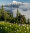
With the Summer hiking season winding down but still great weather overall, I figured there still might be enough time for intrepid hikers and trail runners to try for Miners Ridge. This lookout currently has the distinction of being the furthest standing Washington lookout from an official trailhead. Hence, this trip report might be usable, or at least a good read.
Due to the partial closure of Suiattle River Road... and because the approaches from the north, east, and south were all still snowbound... this trek was a whopping 55 miles roundtrip for me. The first 10 miles to Downey Creek were via bicycle, as were the final 10 miles on the return. That left 35 miles of road/trail hiking.
The nice thing about the road closure was that I had the road and trails to myself. After getting a late afternoon start on Friday, July 25, I rode my bike to Downey Creek. I was anticipating needing to find a safe spot to ford the creek (which was more like a raging river in places) but fortunately the construction workers had left their ladder setup on the remaining section of bridge still standing at the site.
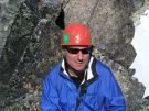
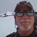
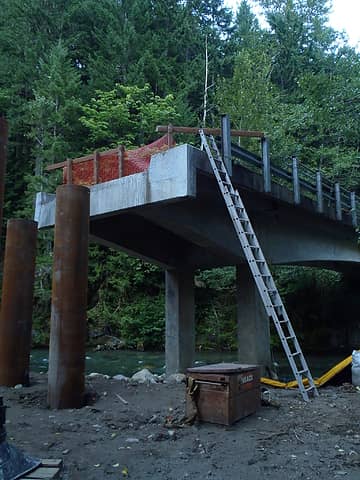 A welcome surprise! 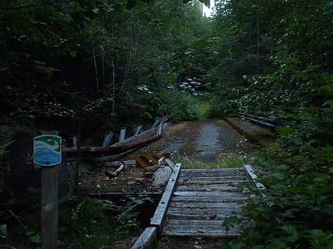 No driving on this bridge! 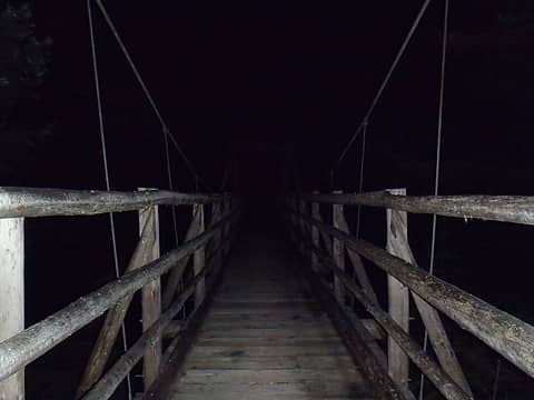 Suspension bridge near camp 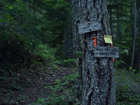 Go this way! 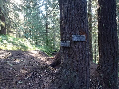 Go that way! 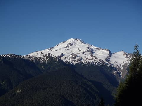 Glacier Peak 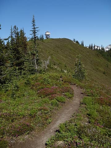 Almost there! 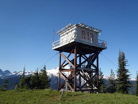 Great place for a lookout tower! 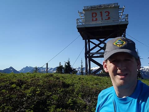 Miners Selfie 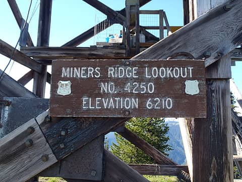 I saw the sign, and it opened up my eyes 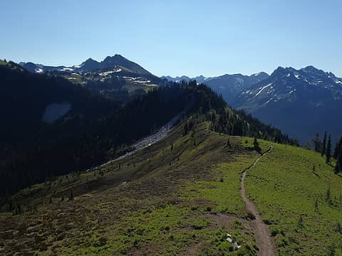 Looking east towards Plummer... 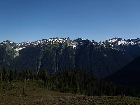 Stonehenge Ridge 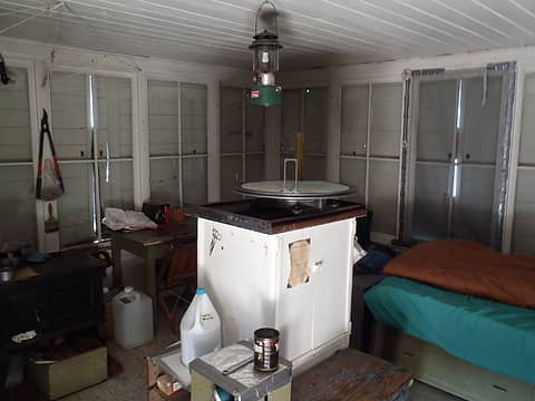 Ready for action! 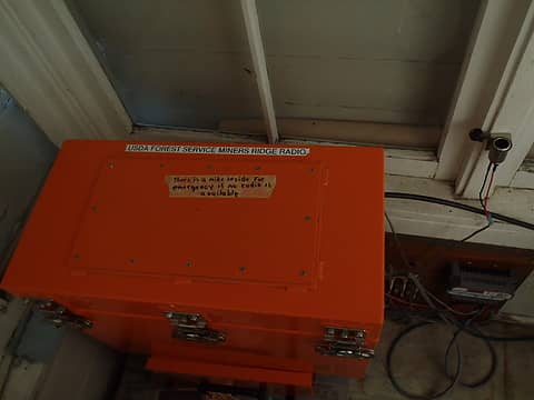 "Calling all lookouts!" 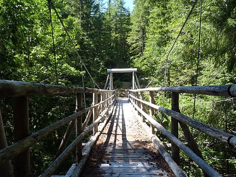 Suspension bridge during daytime
60 pounds lighter but not 60 points brighter.
60 pounds lighter but not 60 points brighter.
|
| Back to top |
  
|
|
Paul M
Member
Joined: 15 Jul 2008
Posts: 371 | TRs | Pics
|
|
Paul M
Member
|
Mon Sep 15, 2014 11:32 am |
|
|
| Redwic wrote: | | my roundtrip time was only a little more than 25 hours total for the entire trek roundtrip. I am not a trail runner but I still could have easily done this trip in less that 24 hours. I basically just took my sweet time... |
Strong work. you are a machine.
|
| Back to top |
|
|
Redwic
Unlisted Free Agent
Joined: 23 Feb 2009
Posts: 3294 | TRs | Pics
Location: Going to the Prom(inence) |
|
Redwic
Unlisted Free Agent
|
Mon Sep 15, 2014 11:34 am |
|
|
Biking 20 of the total miles helps... although the several hours of sleep wipe out much of the time saved. 
60 pounds lighter but not 60 points brighter.
60 pounds lighter but not 60 points brighter.
|
| Back to top |
|
|
neek
Member

Joined: 12 Sep 2011
Posts: 2343 | TRs | Pics
Location: Seattle, WA |
|
neek
Member
|
Mon Sep 15, 2014 11:46 am |
|
|
When I was at that lookout last week the porch was open but a sign said not to go inside.
I have unfinished business on Plummer as well...
|
| Back to top |
|
|
Redwic
Unlisted Free Agent
Joined: 23 Feb 2009
Posts: 3294 | TRs | Pics
Location: Going to the Prom(inence) |
|
Redwic
Unlisted Free Agent
|
Mon Sep 15, 2014 11:48 am |
|
|
| neek wrote: | | When I was at that lookout last week the porch was open but a sign said not to go inside. |
That probably went up during the last month or so, after I reported my findings to a ranger.
60 pounds lighter but not 60 points brighter.
60 pounds lighter but not 60 points brighter.
|
| Back to top |
|
|
neek
Member
Joined: 12 Sep 2011
Posts: 2343 | TRs | Pics
Location: Seattle, WA |
|
neek
Member
|
Mon Sep 15, 2014 3:24 pm |
|
|
Ah, didn't catch that this was in July. Anyway, nice pace, despite cheating w/ the bike 
|
| Back to top |
|
|
fyodorova
Member
Joined: 29 Apr 2012
Posts: 93 | TRs | Pics
|
We visited Miners' Ridge lookout on 8/7/14 as a side trip from the Spider Gap-Buck Creek Pass loop. There was a great view of smoke plumes from the Duncan fire to the southeast, and we joked that the lookout should be staffed! Then a young couple arrived from down the hill carrying up a supply of water. They were staying in the lookout to repair the door, and they graciously invited us inside. It turned out that they were spending their honeymoon repairing the lookout! What a beautiful place for a honeymoon and a nice act of volunteerism. I think their names were Bryce and Kristin (sp?) from Darrington, Bryce had previously worked for the Forest Service and volunteered his time.
Standing on the lookout porch felt like being at the end of the earth.
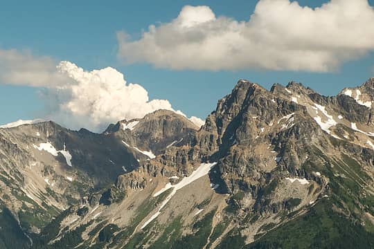 Smoke plume from a wildfire
|
| Back to top |
|
|
contour5
Member

Joined: 16 Jul 2003
Posts: 2964 | TRs | Pics
|
|
contour5
Member
|
Mon Sep 15, 2014 8:38 pm |
|
|
What a cool place! Pretty impressive 25 hr whirlwind... I think it took me a week to get out there and back.
|
| Back to top |
|
|
Hulksmash
Cleaning up.

Joined: 20 Apr 2008
Posts: 7113 | TRs | Pics
Location: Arlington |
|
Hulksmash
Cleaning up.
|
Tue Sep 16, 2014 12:31 pm |
|
|
| Redwic wrote: | No driving on this bridge! |
The Sulphur Creek Bridge will be repaired.
Sulphur Creek Campground will be restored. Here is the Scoping letter
The bridge it self is structurally sound, it's the approach that needs repairs. The wood structure sitting on top is temporary to allow stock to cross the gap created by the washout of the bridge approach.
Sulphur Creek Bridge repairs won't happen till Downy Creek Bridge is repaired.
Realize that trail reconstruction has been on going for the last 10 years.
"Bears couldn't care less about us....we smell bad and don't taste too good. Bugs on the other hand see us as vending machines." - WetDog
Albuterol! it's the 11th essential
"Bears couldn't care less about us....we smell bad and don't taste too good. Bugs on the other hand see us as vending machines." - WetDog
Albuterol! it's the 11th essential
|
| Back to top |
|
|
Bryan K
Shameless Peakbagger

Joined: 29 Sep 2005
Posts: 5129 | TRs | Pics
Location: Alaska |
|
Bryan K
Shameless Peakbagger
|
Tue Sep 16, 2014 6:13 pm |
|
|
Awesome trip buddy!!!!! Thanks for sharing, even if it was a few months ago
|
| Back to top |
|
|
Redwic
Unlisted Free Agent
Joined: 23 Feb 2009
Posts: 3294 | TRs | Pics
Location: Going to the Prom(inence) |
|
Redwic
Unlisted Free Agent
|
Tue Sep 16, 2014 11:09 pm |
|
|
| Hulksmash wrote: | | The Sulphur Creek Bridge will be repaired. |
Woohoo!
Even if it takes a while, that is still great news.
What a neat area of the mountains.
60 pounds lighter but not 60 points brighter.
60 pounds lighter but not 60 points brighter.
|
| Back to top |
|
|
lookout bob
WTA proponent.....

Joined: 12 Apr 2005
Posts: 3048 | TRs | Pics
Location: wta work while in between lookouts |
|
lookout bob
WTA proponent.....
|
Wed Sep 17, 2014 9:29 am |
|
|
nice report!!! I especially like your hat in "miners selfie"!!! 
"Altitude is its own reward"
John Jerome ( from "On Mountains")
"Altitude is its own reward"
John Jerome ( from "On Mountains")
|
| Back to top |
|
|
Overkill
Member
Joined: 24 Jul 2011
Posts: 34 | TRs | Pics
Location: Darrington, Wa |
|
Overkill
Member
|
Wed Sep 17, 2014 3:54 pm |
|
|
I went up there when I worked for the US Forest Service on the District there in 1988, and it was quite a hike back then! I have also heard they'll have that road reopened soon so we all can finally have access to our old favorite trails and campsites without having to put too much logistics into it as we have over the years since the floods tore out the road.
|
| Back to top |
|
|
Kim Brown
Member

Joined: 13 Jul 2009
Posts: 6900 | TRs | Pics
|
| Hesman wrote: | | This was in 2001 when I was at the lookout and I have wondered how much longer the couple were lookouts at Miners Ridge. If I remember correctly, they mentioned they were in their early 70's at the tim |
The Hardys. I think you're right that they were up there for 12 seasons. Nice folks; they do a lot of volunteer work on trails.
The flood of 2006 made it impossible for them to get to Miners Ridge, so 06 was their last year. A gent named Fred took over time and again he was there last summer - I don't know about this summer. To get Fred there, we walked the road from Downey and camped at Canyon Creek. Horse packers arrived the next day and dropped off Freds gear for a 3 week stay at Miners Ridge. From there, Fred and George schlepped the buckets up to the Lookout. I think George took 2 or 3 trips from the start of the Miners Ridge trail to the lookout, hauling them up.
The last I heard, the Hardy will not return to Miners Ridge; since the road washed out, as with anyone as time goes by, they are not able to make the trek, even after its repaired to the Suiattle Trail head.
The road is scheduled to open this fall.
"..living on the east side of the Sierra world be ideal - except for harsher winters and the chance of apocalyptic fires burning the whole area."
Bosterson, NWHiker's marketing expert
"..living on the east side of the Sierra world be ideal - except for harsher winters and the chance of apocalyptic fires burning the whole area."
Bosterson, NWHiker's marketing expert
|
| Back to top |
|
|
Overkill
Member
Joined: 24 Jul 2011
Posts: 34 | TRs | Pics
Location: Darrington, Wa |
|
Overkill
Member
|
Wed Sep 17, 2014 4:37 pm |
|
|
|
| Back to top |
|
|
|
|


